L40A Anamosa, IA, USA - Earthquake Result Viewer
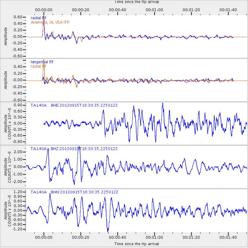
Earthquake location: Andreanof Islands, Aleutian Is.
Earthquake latitude/longitude: 51.6/-174.7
Earthquake time(UTC): 2013/09/15 (258) 16:21:37 GMT
Earthquake Depth: 24 km
Earthquake Magnitude: 6.1 MWW, 5.7 MI, 5.7 ML, 6.0 MWB, 6.1 MWC, 6.1 MWW
Earthquake Catalog/Contributor: NEIC PDE/NEIC COMCAT
Network: TA USArray Transportable Network (new EarthScope stations)
Station: L40A Anamosa, IA, USA
Lat/Lon: 42.06 N/91.22 W
Elevation: 242 m
Distance: 55.0 deg
Az: 64.644 deg
Baz: 310.772 deg
Ray Param: 0.0650771
Estimated Moho Depth: 32.25 km
Estimated Crust Vp/Vs: 1.87
Assumed Crust Vp: 6.53 km/s
Estimated Crust Vs: 3.497 km/s
Estimated Crust Poisson's Ratio: 0.30
Radial Match: 89.603134 %
Radial Bump: 400
Transverse Match: 70.289986 %
Transverse Bump: 400
SOD ConfigId: 626651
Insert Time: 2014-04-18 17:26:49.171 +0000
GWidth: 2.5
Max Bumps: 400
Tol: 0.001

Signal To Noise

ChannelStoNSTALTA
TA:L40A: :BHZ:20130915T16:30:35.225012Z7.9683811.2683794E-61.5917655E-7
TA:L40A: :BHN:20130915T16:30:35.225012Z4.23910865.3674495E-71.2661741E-7
TA:L40A: :BHE:20130915T16:30:35.225012Z3.77085573.302297E-78.757421E-8
Arrivals
Ps4.5 SECOND
PpPs13 SECOND
PsPs/PpSs18 SECOND