L46A Eue Claire, MI, USA - Earthquake Result Viewer
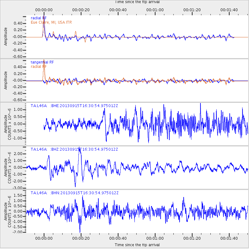
Earthquake location: Andreanof Islands, Aleutian Is.
Earthquake latitude/longitude: 51.6/-174.7
Earthquake time(UTC): 2013/09/15 (258) 16:21:37 GMT
Earthquake Depth: 24 km
Earthquake Magnitude: 6.1 MWW, 5.7 MI, 5.7 ML, 6.0 MWB, 6.1 MWC, 6.1 MWW
Earthquake Catalog/Contributor: NEIC PDE/NEIC COMCAT
Network: TA USArray Transportable Network (new EarthScope stations)
Station: L46A Eue Claire, MI, USA
Lat/Lon: 42.01 N/86.30 W
Elevation: 223 m
Distance: 57.7 deg
Az: 61.762 deg
Baz: 312.461 deg
Ray Param: 0.06326922
Estimated Moho Depth: 30.75 km
Estimated Crust Vp/Vs: 1.60
Assumed Crust Vp: 6.483 km/s
Estimated Crust Vs: 4.052 km/s
Estimated Crust Poisson's Ratio: 0.18
Radial Match: 85.99045 %
Radial Bump: 400
Transverse Match: 67.62479 %
Transverse Bump: 400
SOD ConfigId: 626651
Insert Time: 2014-04-18 17:26:54.428 +0000
GWidth: 2.5
Max Bumps: 400
Tol: 0.001

Signal To Noise

ChannelStoNSTALTA
TA:L46A: :BHZ:20130915T16:30:54.975012Z4.5646579.4973717E-72.080632E-7
TA:L46A: :BHN:20130915T16:30:54.975012Z1.86119783.8368717E-72.0615066E-7
TA:L46A: :BHE:20130915T16:30:54.975012Z2.92303925.701726E-71.9506156E-7
Arrivals
Ps3.0 SECOND
PpPs12 SECOND
PsPs/PpSs15 SECOND