L48A N Adams, MI, USA - Earthquake Result Viewer
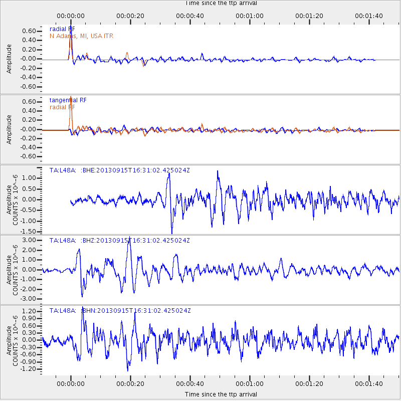
Earthquake location: Andreanof Islands, Aleutian Is.
Earthquake latitude/longitude: 51.6/-174.7
Earthquake time(UTC): 2013/09/15 (258) 16:21:37 GMT
Earthquake Depth: 24 km
Earthquake Magnitude: 6.1 MWW, 5.7 MI, 5.7 ML, 6.0 MWB, 6.1 MWC, 6.1 MWW
Earthquake Catalog/Contributor: NEIC PDE/NEIC COMCAT
Network: TA USArray Transportable Network (new EarthScope stations)
Station: L48A N Adams, MI, USA
Lat/Lon: 41.94 N/84.43 W
Elevation: 369 m
Distance: 58.8 deg
Az: 60.712 deg
Baz: 313.15 deg
Ray Param: 0.062575355
Estimated Moho Depth: 23.75 km
Estimated Crust Vp/Vs: 1.66
Assumed Crust Vp: 6.498 km/s
Estimated Crust Vs: 3.908 km/s
Estimated Crust Poisson's Ratio: 0.22
Radial Match: 88.40647 %
Radial Bump: 400
Transverse Match: 77.100006 %
Transverse Bump: 400
SOD ConfigId: 626651
Insert Time: 2014-04-18 17:27:03.263 +0000
GWidth: 2.5
Max Bumps: 400
Tol: 0.001

Signal To Noise

ChannelStoNSTALTA
TA:L48A: :BHZ:20130915T16:31:02.425024Z10.4869651.304796E-61.2442074E-7
TA:L48A: :BHN:20130915T16:31:02.425024Z4.38926845.8072544E-71.3230574E-7
TA:L48A: :BHE:20130915T16:31:02.425024Z5.6242136.939348E-71.2338344E-7
Arrivals
Ps2.6 SECOND
PpPs9.2 SECOND
PsPs/PpSs12 SECOND