L49A Milan, MI, USA - Earthquake Result Viewer
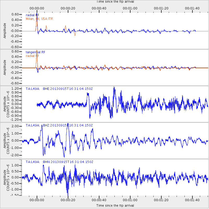
Earthquake location: Andreanof Islands, Aleutian Is.
Earthquake latitude/longitude: 51.6/-174.7
Earthquake time(UTC): 2013/09/15 (258) 16:21:37 GMT
Earthquake Depth: 24 km
Earthquake Magnitude: 6.1 MWW, 5.7 MI, 5.7 ML, 6.0 MWB, 6.1 MWC, 6.1 MWW
Earthquake Catalog/Contributor: NEIC PDE/NEIC COMCAT
Network: TA USArray Transportable Network (new EarthScope stations)
Station: L49A Milan, MI, USA
Lat/Lon: 42.11 N/83.77 W
Elevation: 230 m
Distance: 59.0 deg
Az: 60.175 deg
Baz: 313.317 deg
Ray Param: 0.062412728
Estimated Moho Depth: 63.5 km
Estimated Crust Vp/Vs: 1.94
Assumed Crust Vp: 6.483 km/s
Estimated Crust Vs: 3.342 km/s
Estimated Crust Poisson's Ratio: 0.32
Radial Match: 89.44421 %
Radial Bump: 396
Transverse Match: 76.873085 %
Transverse Bump: 400
SOD ConfigId: 626651
Insert Time: 2014-04-18 17:27:06.667 +0000
GWidth: 2.5
Max Bumps: 400
Tol: 0.001

Signal To Noise

ChannelStoNSTALTA
TA:L49A: :BHZ:20130915T16:31:04.150Z6.2424211.0839365E-61.736404E-7
TA:L49A: :BHN:20130915T16:31:04.150Z2.76059034.6302637E-71.677273E-7
TA:L49A: :BHE:20130915T16:31:04.150Z3.75373985.010039E-71.3346794E-7
Arrivals
Ps9.6 SECOND
PpPs28 SECOND
PsPs/PpSs37 SECOND