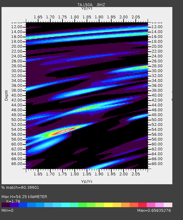
L50A Kingsville, ON, CAN - Earthquake Result Viewer

Earthquake location: Andreanof Islands, Aleutian Is.
Earthquake latitude/longitude: 51.6/-174.7
Earthquake time(UTC): 2013/09/15 (258) 16:21:37 GMT
Earthquake Depth: 24 km
Earthquake Magnitude: 6.1 MWW, 5.7 MI, 5.7 ML, 6.0 MWB, 6.1 MWC, 6.1 MWW
Earthquake Catalog/Contributor: NEIC PDE/NEIC COMCAT
Network: TA USArray Transportable Network (new EarthScope stations)
Station: L50A Kingsville, ON, CAN
Lat/Lon: 42.04 N/82.81 W
Elevation: 187 m
Distance: 59.6 deg
Az: 59.66 deg
Baz: 313.693 deg
Ray Param: 0.06204124
Estimated Moho Depth: 54.25 km
Estimated Crust Vp/Vs: 1.76
Assumed Crust Vp: 6.483 km/s
Estimated Crust Vs: 3.683 km/s
Estimated Crust Poisson's Ratio: 0.26
Radial Match: 90.39901 %
Radial Bump: 400
Transverse Match: 76.562675 %
Transverse Bump: 390
SOD ConfigId: 626651
Insert Time: 2014-04-18 17:27:08.852 +0000
GWidth: 2.5
Max Bumps: 400
Tol: 0.001

Signal To Noise

ChannelStoNSTALTA
TA:L50A: :BHZ:20130915T16:31:08.024023Z7.6367268.9505545E-71.1720408E-7
TA:L50A: :BHN:20130915T16:31:08.024023Z2.53397352.762029E-71.0899993E-7
TA:L50A: :BHE:20130915T16:31:08.024023Z3.23754333.5669999E-71.10176124E-7
Arrivals
Ps6.7 SECOND
PpPs22 SECOND
PsPs/PpSs29 SECOND