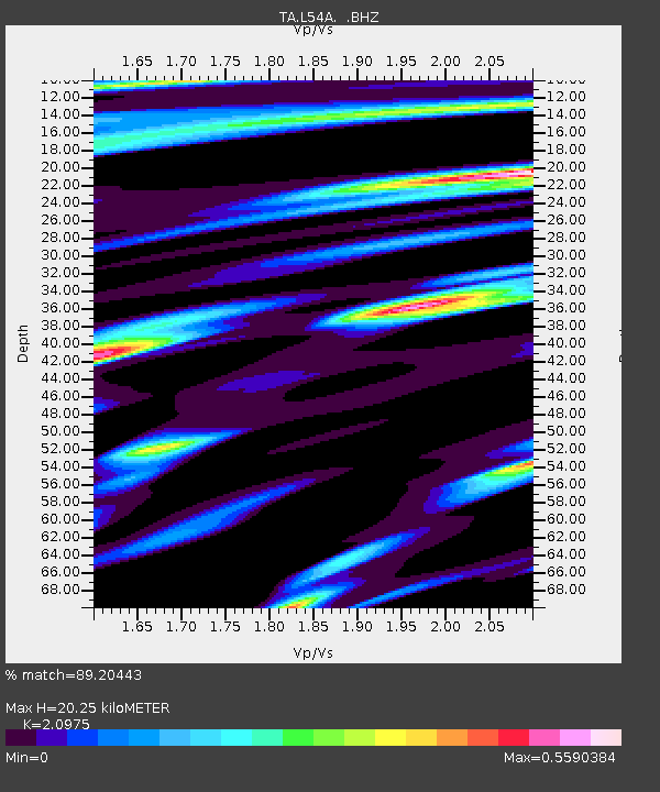
L54A Sinclairville, NY, USA - Earthquake Result Viewer
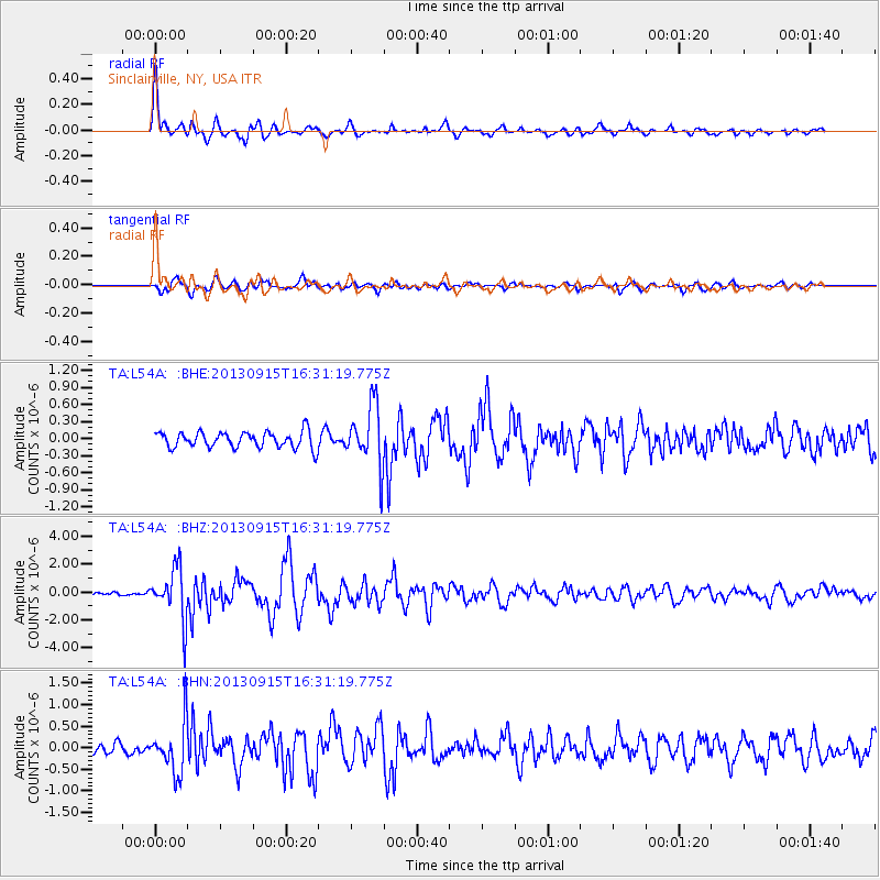
Earthquake location: Andreanof Islands, Aleutian Is.
Earthquake latitude/longitude: 51.6/-174.7
Earthquake time(UTC): 2013/09/15 (258) 16:21:37 GMT
Earthquake Depth: 24 km
Earthquake Magnitude: 6.1 MWW, 5.7 MI, 5.7 ML, 6.0 MWB, 6.1 MWC, 6.1 MWW
Earthquake Catalog/Contributor: NEIC PDE/NEIC COMCAT
Network: TA USArray Transportable Network (new EarthScope stations)
Station: L54A Sinclairville, NY, USA
Lat/Lon: 42.23 N/79.32 W
Elevation: 432 m
Distance: 61.3 deg
Az: 57.417 deg
Baz: 314.923 deg
Ray Param: 0.060906194
Estimated Moho Depth: 20.25 km
Estimated Crust Vp/Vs: 2.10
Assumed Crust Vp: 6.419 km/s
Estimated Crust Vs: 3.06 km/s
Estimated Crust Poisson's Ratio: 0.35
Radial Match: 89.20443 %
Radial Bump: 400
Transverse Match: 75.37825 %
Transverse Bump: 400
SOD ConfigId: 626651
Insert Time: 2014-04-18 17:27:14.993 +0000
GWidth: 2.5
Max Bumps: 400
Tol: 0.001

Signal To Noise

ChannelStoNSTALTA
TA:L54A: :BHZ:20130915T16:31:19.775Z10.5932771.8307659E-61.7282338E-7
TA:L54A: :BHN:20130915T16:31:19.775Z3.59531935.9245997E-71.6478646E-7
TA:L54A: :BHE:20130915T16:31:19.775Z3.74874475.305785E-71.4153497E-7
Arrivals
Ps3.6 SECOND
PpPs9.4 SECOND
PsPs/PpSs13 SECOND