
L56A Greenwood, NY, USA - Earthquake Result Viewer
| ||||||||||||||||||
| ||||||||||||||||||
| ||||||||||||||||||
|
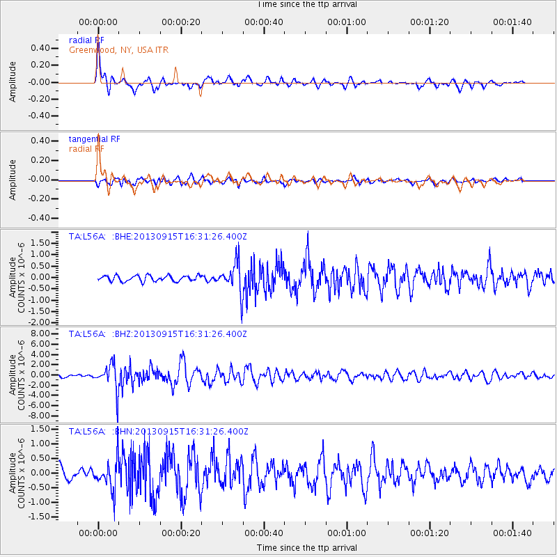
Signal To Noise
| Channel | StoN | STA | LTA |
| TA:L56A: :BHZ:20130915T16:31:26.400Z | 10.76098 | 2.6099726E-6 | 2.4254044E-7 |
| TA:L56A: :BHN:20130915T16:31:26.400Z | 2.7216573 | 5.308307E-7 | 1.9503949E-7 |
| TA:L56A: :BHE:20130915T16:31:26.400Z | 5.548367 | 6.9058234E-7 | 1.2446587E-7 |
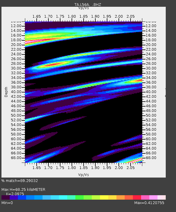
| Arrivals | |
| Ps | 12 SECOND |
| PpPs | 31 SECOND |
| PsPs/PpSs | 43 SECOND |

