
M47A Cromwell, IN, USA - Earthquake Result Viewer
| ||||||||||||||||||
| ||||||||||||||||||
| ||||||||||||||||||
|
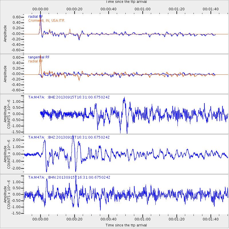
Signal To Noise
| Channel | StoN | STA | LTA |
| TA:M47A: :BHZ:20130915T16:31:00.675024Z | 8.7662325 | 1.2373993E-6 | 1.411552E-7 |
| TA:M47A: :BHN:20130915T16:31:00.675024Z | 2.9086723 | 5.311919E-7 | 1.8262351E-7 |
| TA:M47A: :BHE:20130915T16:31:00.675024Z | 2.8343613 | 5.046584E-7 | 1.7805012E-7 |
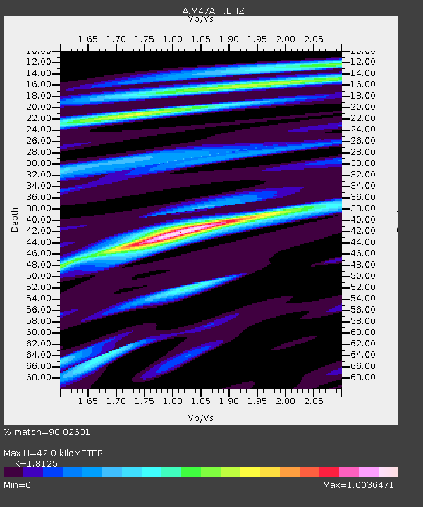
| Arrivals | |
| Ps | 5.5 SECOND |
| PpPs | 17 SECOND |
| PsPs/PpSs | 23 SECOND |

