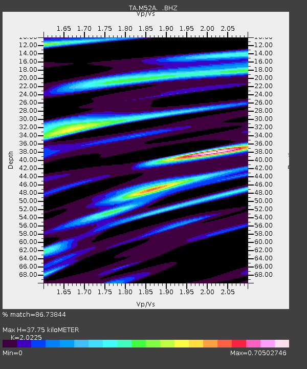
M52A Chesterland, OH, USA - Earthquake Result Viewer
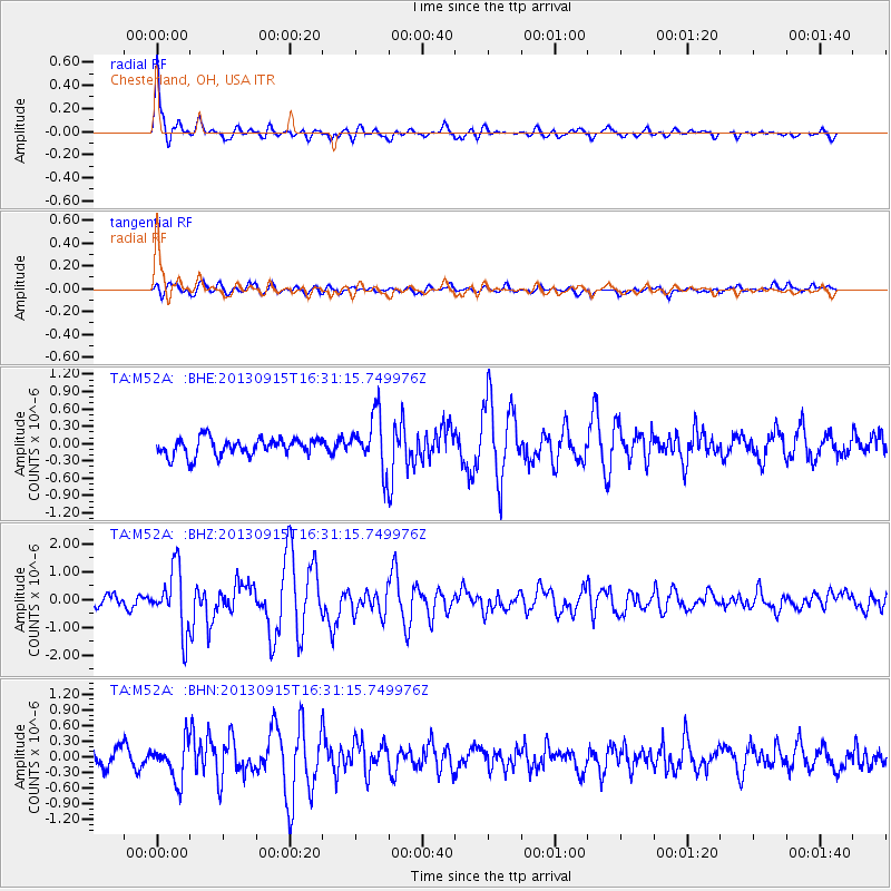
Earthquake location: Andreanof Islands, Aleutian Is.
Earthquake latitude/longitude: 51.6/-174.7
Earthquake time(UTC): 2013/09/15 (258) 16:21:37 GMT
Earthquake Depth: 24 km
Earthquake Magnitude: 6.1 MWW, 5.7 MI, 5.7 ML, 6.0 MWB, 6.1 MWC, 6.1 MWW
Earthquake Catalog/Contributor: NEIC PDE/NEIC COMCAT
Network: TA USArray Transportable Network (new EarthScope stations)
Station: M52A Chesterland, OH, USA
Lat/Lon: 41.54 N/81.36 W
Elevation: 382 m
Distance: 60.7 deg
Az: 59.205 deg
Baz: 314.432 deg
Ray Param: 0.061299667
Estimated Moho Depth: 37.75 km
Estimated Crust Vp/Vs: 2.02
Assumed Crust Vp: 6.483 km/s
Estimated Crust Vs: 3.205 km/s
Estimated Crust Poisson's Ratio: 0.34
Radial Match: 86.73844 %
Radial Bump: 383
Transverse Match: 58.395332 %
Transverse Bump: 400
SOD ConfigId: 626651
Insert Time: 2014-04-18 17:28:21.381 +0000
GWidth: 2.5
Max Bumps: 400
Tol: 0.001

Signal To Noise

ChannelStoNSTALTA
TA:M52A: :BHZ:20130915T16:31:15.749976Z7.50473361.1173673E-61.4888833E-7
TA:M52A: :BHN:20130915T16:31:15.749976Z2.0122523.7098644E-71.8436378E-7
TA:M52A: :BHE:20130915T16:31:15.749976Z3.04341034.6585842E-71.5307118E-7
Arrivals
Ps6.2 SECOND
PpPs17 SECOND
PsPs/PpSs23 SECOND