
M53A WI Miller and Sons, Farmdale, OH, USA - Earthquake Result Viewer
| ||||||||||||||||||
| ||||||||||||||||||
| ||||||||||||||||||
|
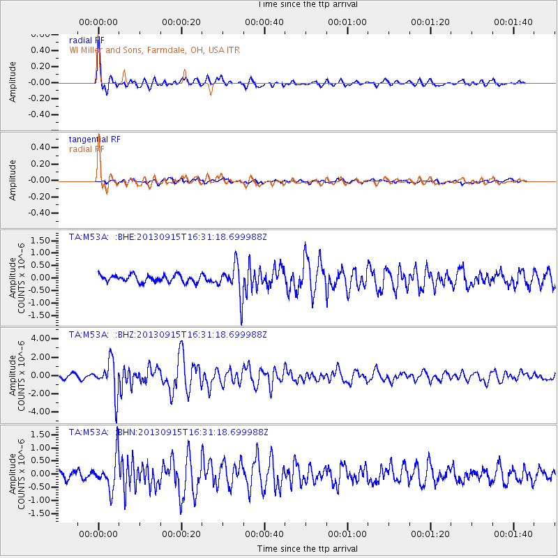
Signal To Noise
| Channel | StoN | STA | LTA |
| TA:M53A: :BHZ:20130915T16:31:18.699988Z | 10.75444 | 1.9027802E-6 | 1.7692973E-7 |
| TA:M53A: :BHN:20130915T16:31:18.699988Z | 4.9308352 | 6.6269973E-7 | 1.3439907E-7 |
| TA:M53A: :BHE:20130915T16:31:18.699988Z | 4.6127005 | 6.647294E-7 | 1.4410851E-7 |
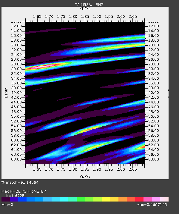
| Arrivals | |
| Ps | 3.1 SECOND |
| PpPs | 11 SECOND |
| PsPs/PpSs | 14 SECOND |

