MSTX Muleshoe, TX, USA - Earthquake Result Viewer
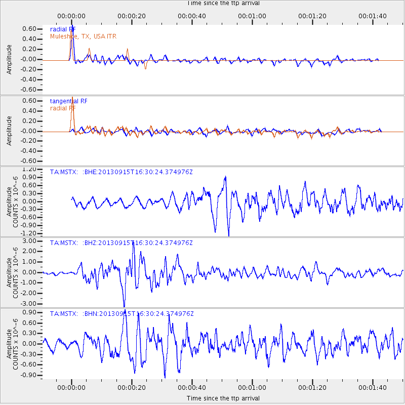
Earthquake location: Andreanof Islands, Aleutian Is.
Earthquake latitude/longitude: 51.6/-174.7
Earthquake time(UTC): 2013/09/15 (258) 16:21:37 GMT
Earthquake Depth: 24 km
Earthquake Magnitude: 6.1 MWW, 5.7 MI, 5.7 ML, 6.0 MWB, 6.1 MWC, 6.1 MWW
Earthquake Catalog/Contributor: NEIC PDE/NEIC COMCAT
Network: TA USArray Transportable Network (new EarthScope stations)
Station: MSTX Muleshoe, TX, USA
Lat/Lon: 33.97 N/102.77 W
Elevation: 1167 m
Distance: 53.5 deg
Az: 79.545 deg
Baz: 312.402 deg
Ray Param: 0.066046216
Estimated Moho Depth: 38.0 km
Estimated Crust Vp/Vs: 1.82
Assumed Crust Vp: 6.129 km/s
Estimated Crust Vs: 3.363 km/s
Estimated Crust Poisson's Ratio: 0.28
Radial Match: 90.39854 %
Radial Bump: 371
Transverse Match: 68.97727 %
Transverse Bump: 400
SOD ConfigId: 626651
Insert Time: 2014-04-18 17:29:08.277 +0000
GWidth: 2.5
Max Bumps: 400
Tol: 0.001

Signal To Noise

ChannelStoNSTALTA
TA:MSTX: :BHZ:20130915T16:30:24.374976Z4.07850464.0013663E-79.8108664E-8
TA:MSTX: :BHN:20130915T16:30:24.374976Z1.20288571.8928026E-71.5735515E-7
TA:MSTX: :BHE:20130915T16:30:24.374976Z1.53253521.9495451E-71.2721046E-7
Arrivals
Ps5.3 SECOND
PpPs17 SECOND
PsPs/PpSs22 SECOND