N47A Urbana, IN, USA - Earthquake Result Viewer
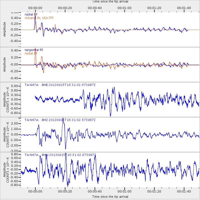
Earthquake location: Andreanof Islands, Aleutian Is.
Earthquake latitude/longitude: 51.6/-174.7
Earthquake time(UTC): 2013/09/15 (258) 16:21:37 GMT
Earthquake Depth: 24 km
Earthquake Magnitude: 6.1 MWW, 5.7 MI, 5.7 ML, 6.0 MWB, 6.1 MWC, 6.1 MWW
Earthquake Catalog/Contributor: NEIC PDE/NEIC COMCAT
Network: TA USArray Transportable Network (new EarthScope stations)
Station: N47A Urbana, IN, USA
Lat/Lon: 40.88 N/85.69 W
Elevation: 252 m
Distance: 58.8 deg
Az: 62.377 deg
Baz: 313.181 deg
Ray Param: 0.06255253
Estimated Moho Depth: 32.75 km
Estimated Crust Vp/Vs: 1.85
Assumed Crust Vp: 6.498 km/s
Estimated Crust Vs: 3.507 km/s
Estimated Crust Poisson's Ratio: 0.29
Radial Match: 88.36592 %
Radial Bump: 400
Transverse Match: 67.7651 %
Transverse Bump: 400
SOD ConfigId: 626651
Insert Time: 2014-04-18 17:29:16.370 +0000
GWidth: 2.5
Max Bumps: 400
Tol: 0.001

Signal To Noise

ChannelStoNSTALTA
TA:N47A: :BHZ:20130915T16:31:02.673987Z10.744051.0690151E-69.949833E-8
TA:N47A: :BHN:20130915T16:31:02.673987Z3.5152073.8743266E-71.1021618E-7
TA:N47A: :BHE:20130915T16:31:02.673987Z3.35346723.39936E-71.01368514E-7
Arrivals
Ps4.5 SECOND
PpPs14 SECOND
PsPs/PpSs18 SECOND