
N50A Nevada, OH, USA - Earthquake Result Viewer
| ||||||||||||||||||
| ||||||||||||||||||
| ||||||||||||||||||
|
Signal To Noise
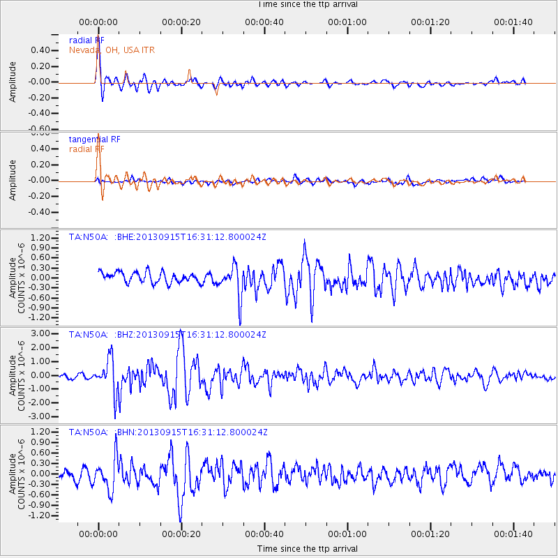
| Channel | StoN | STA | LTA |
| TA:N50A: :BHZ:20130915T16:31:12.800024Z | 7.965672 | 1.2460923E-6 | 1.5643279E-7 |
| TA:N50A: :BHN:20130915T16:31:12.800024Z | 3.2870233 | 4.8270186E-7 | 1.4685075E-7 |
| TA:N50A: :BHE:20130915T16:31:12.800024Z | 3.1955023 | 4.9200935E-7 | 1.5396932E-7 |
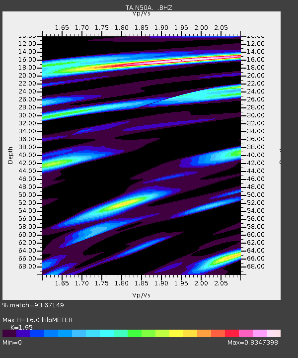
| Arrivals | |
| Ps | 2.4 SECOND |
| PpPs | 7.0 SECOND |
| PsPs/PpSs | 9.4 SECOND |

