
N54A Moraine State Park, Portersville, PA, USA - Earthquake Result Viewer
| ||||||||||||||||||
| ||||||||||||||||||
| ||||||||||||||||||
|
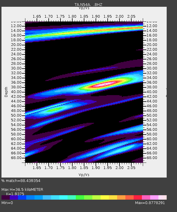
Signal To Noise
| Channel | StoN | STA | LTA |
| TA:N54A: :BHZ:20130915T16:31:23.425024Z | 9.437742 | 1.4901991E-6 | 1.5789784E-7 |
| TA:N54A: :BHN:20130915T16:31:23.425024Z | 4.06437 | 4.7456328E-7 | 1.1676183E-7 |
| TA:N54A: :BHE:20130915T16:31:23.425024Z | 2.7350485 | 4.0125016E-7 | 1.4670678E-7 |
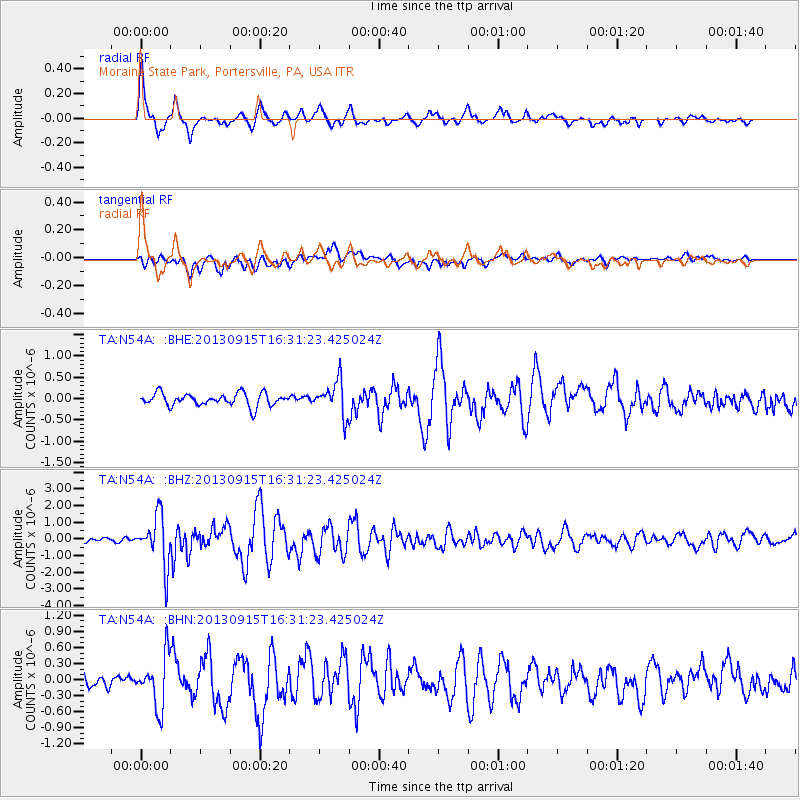
| Arrivals | |
| Ps | 5.8 SECOND |
| PpPs | 17 SECOND |
| PsPs/PpSs | 23 SECOND |

