N60A Cedar Hill Farm, Mount Bethel, PA, USA - Earthquake Result Viewer
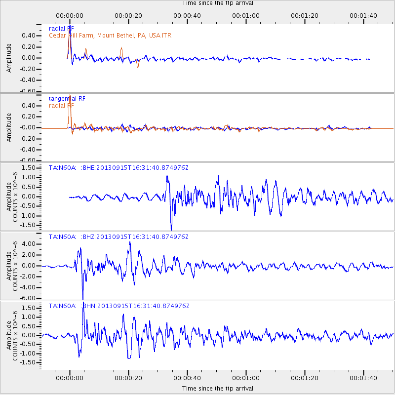
Earthquake location: Andreanof Islands, Aleutian Is.
Earthquake latitude/longitude: 51.6/-174.7
Earthquake time(UTC): 2013/09/15 (258) 16:21:37 GMT
Earthquake Depth: 24 km
Earthquake Magnitude: 6.1 MWW, 5.7 MI, 5.7 ML, 6.0 MWB, 6.1 MWC, 6.1 MWW
Earthquake Catalog/Contributor: NEIC PDE/NEIC COMCAT
Network: TA USArray Transportable Network (new EarthScope stations)
Station: N60A Cedar Hill Farm, Mount Bethel, PA, USA
Lat/Lon: 40.87 N/75.10 W
Elevation: 189 m
Distance: 64.5 deg
Az: 55.925 deg
Baz: 317.031 deg
Ray Param: 0.058842223
Estimated Moho Depth: 36.75 km
Estimated Crust Vp/Vs: 1.84
Assumed Crust Vp: 6.283 km/s
Estimated Crust Vs: 3.42 km/s
Estimated Crust Poisson's Ratio: 0.29
Radial Match: 92.487564 %
Radial Bump: 400
Transverse Match: 74.52018 %
Transverse Bump: 400
SOD ConfigId: 626651
Insert Time: 2014-04-18 17:29:50.415 +0000
GWidth: 2.5
Max Bumps: 400
Tol: 0.001

Signal To Noise

ChannelStoNSTALTA
TA:N60A: :BHZ:20130915T16:31:40.874976Z12.3385811.9808786E-61.6054346E-7
TA:N60A: :BHN:20130915T16:31:40.874976Z5.03891666.384509E-71.2670401E-7
TA:N60A: :BHE:20130915T16:31:40.874976Z6.9166516.1846436E-78.941674E-8
Arrivals
Ps5.1 SECOND
PpPs16 SECOND
PsPs/PpSs21 SECOND