N61A South Mountain, Millburn, NJ, USA - Earthquake Result Viewer
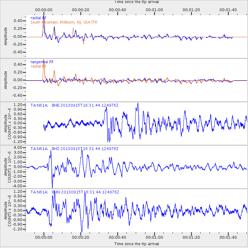
Earthquake location: Andreanof Islands, Aleutian Is.
Earthquake latitude/longitude: 51.6/-174.7
Earthquake time(UTC): 2013/09/15 (258) 16:21:37 GMT
Earthquake Depth: 24 km
Earthquake Magnitude: 6.1 MWW, 5.7 MI, 5.7 ML, 6.0 MWB, 6.1 MWC, 6.1 MWW
Earthquake Catalog/Contributor: NEIC PDE/NEIC COMCAT
Network: TA USArray Transportable Network (new EarthScope stations)
Station: N61A South Mountain, Millburn, NJ, USA
Lat/Lon: 40.75 N/74.30 W
Elevation: 108 m
Distance: 65.0 deg
Az: 55.519 deg
Baz: 317.381 deg
Ray Param: 0.05851802
Estimated Moho Depth: 35.25 km
Estimated Crust Vp/Vs: 1.96
Assumed Crust Vp: 6.283 km/s
Estimated Crust Vs: 3.214 km/s
Estimated Crust Poisson's Ratio: 0.32
Radial Match: 87.185585 %
Radial Bump: 400
Transverse Match: 70.76197 %
Transverse Bump: 400
SOD ConfigId: 626651
Insert Time: 2014-04-18 17:29:54.841 +0000
GWidth: 2.5
Max Bumps: 400
Tol: 0.001

Signal To Noise

ChannelStoNSTALTA
TA:N61A: :BHZ:20130915T16:31:44.124976Z9.2984521.563135E-61.68107E-7
TA:N61A: :BHN:20130915T16:31:44.124976Z3.96712114.9027705E-71.235851E-7
TA:N61A: :BHE:20130915T16:31:44.124976Z3.97196415.260989E-71.3245308E-7
Arrivals
Ps5.6 SECOND
PpPs16 SECOND
PsPs/PpSs22 SECOND