O44A Mansfield, IL, USA - Earthquake Result Viewer
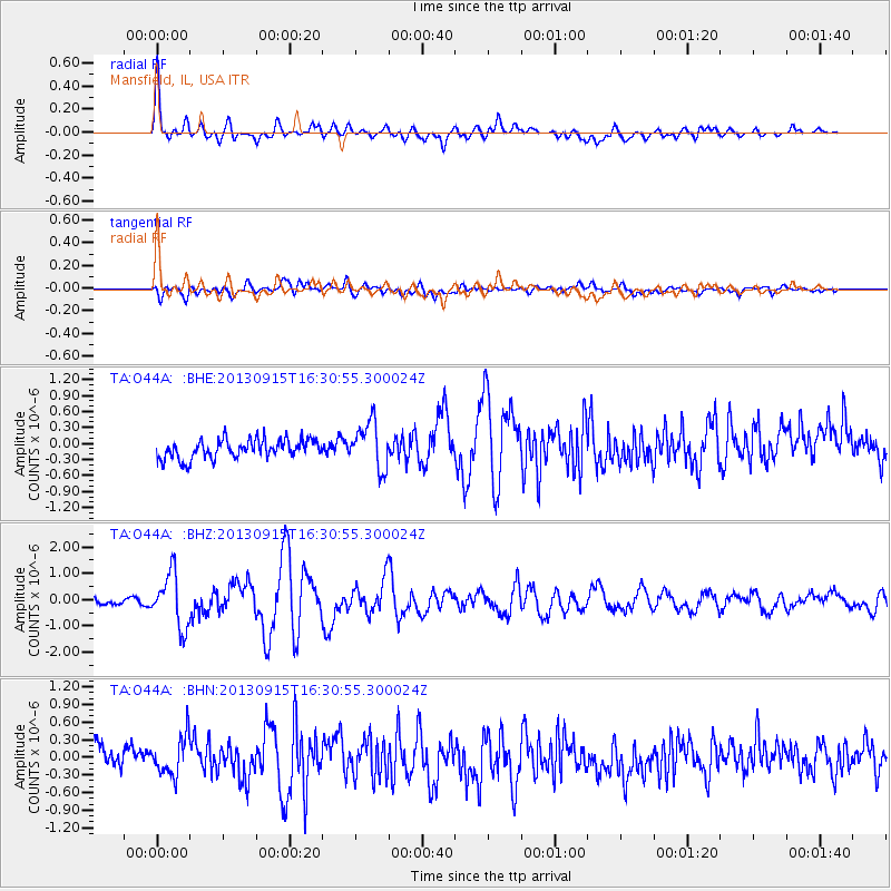
Earthquake location: Andreanof Islands, Aleutian Is.
Earthquake latitude/longitude: 51.6/-174.7
Earthquake time(UTC): 2013/09/15 (258) 16:21:37 GMT
Earthquake Depth: 24 km
Earthquake Magnitude: 6.1 MWW, 5.7 MI, 5.7 ML, 6.0 MWB, 6.1 MWC, 6.1 MWW
Earthquake Catalog/Contributor: NEIC PDE/NEIC COMCAT
Network: TA USArray Transportable Network (new EarthScope stations)
Station: O44A Mansfield, IL, USA
Lat/Lon: 40.15 N/88.47 W
Elevation: 213 m
Distance: 57.8 deg
Az: 64.693 deg
Baz: 312.603 deg
Ray Param: 0.063239455
Estimated Moho Depth: 23.75 km
Estimated Crust Vp/Vs: 2.10
Assumed Crust Vp: 6.498 km/s
Estimated Crust Vs: 3.098 km/s
Estimated Crust Poisson's Ratio: 0.35
Radial Match: 82.484825 %
Radial Bump: 400
Transverse Match: 62.010387 %
Transverse Bump: 400
SOD ConfigId: 626651
Insert Time: 2014-04-18 17:30:00.059 +0000
GWidth: 2.5
Max Bumps: 400
Tol: 0.001

Signal To Noise

ChannelStoNSTALTA
TA:O44A: :BHZ:20130915T16:30:55.300024Z6.7402921.0201095E-61.5134499E-7
TA:O44A: :BHN:20130915T16:30:55.300024Z1.65022373.2158917E-71.9487611E-7
TA:O44A: :BHE:20130915T16:30:55.300024Z2.47857364.3997196E-71.7751015E-7
Arrivals
Ps4.2 SECOND
PpPs11 SECOND
PsPs/PpSs15 SECOND