O48A Farmland, IN, USA - Earthquake Result Viewer
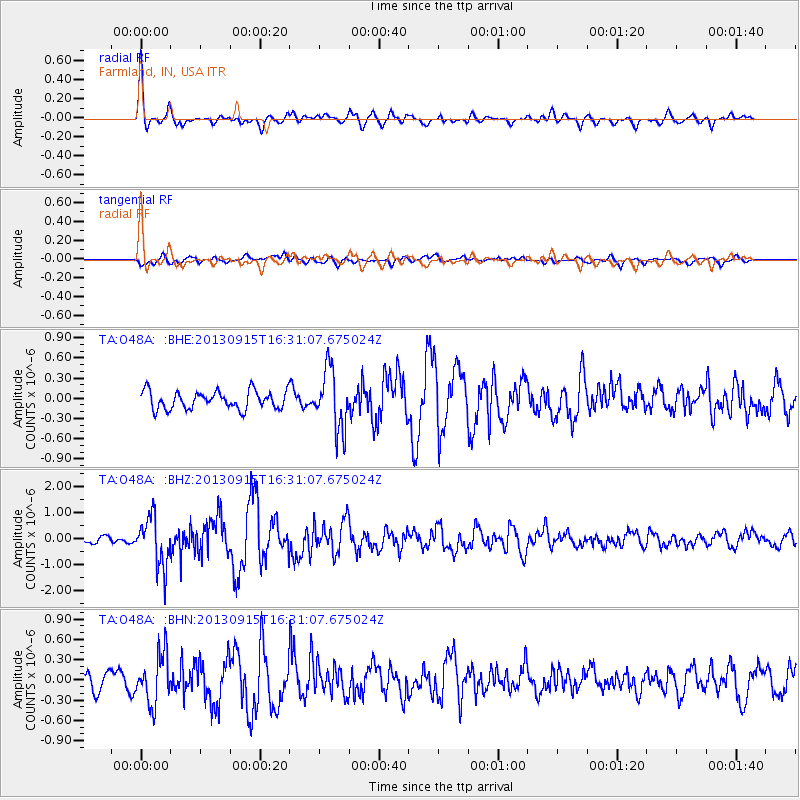
Earthquake location: Andreanof Islands, Aleutian Is.
Earthquake latitude/longitude: 51.6/-174.7
Earthquake time(UTC): 2013/09/15 (258) 16:21:37 GMT
Earthquake Depth: 24 km
Earthquake Magnitude: 6.1 MWW, 5.7 MI, 5.7 ML, 6.0 MWB, 6.1 MWC, 6.1 MWW
Earthquake Catalog/Contributor: NEIC PDE/NEIC COMCAT
Network: TA USArray Transportable Network (new EarthScope stations)
Station: O48A Farmland, IN, USA
Lat/Lon: 40.26 N/85.16 W
Elevation: 300 m
Distance: 59.6 deg
Az: 62.574 deg
Baz: 313.631 deg
Ray Param: 0.062073793
Estimated Moho Depth: 31.0 km
Estimated Crust Vp/Vs: 1.96
Assumed Crust Vp: 6.498 km/s
Estimated Crust Vs: 3.315 km/s
Estimated Crust Poisson's Ratio: 0.32
Radial Match: 85.71952 %
Radial Bump: 400
Transverse Match: 66.54129 %
Transverse Bump: 400
SOD ConfigId: 626651
Insert Time: 2014-04-18 17:30:04.843 +0000
GWidth: 2.5
Max Bumps: 400
Tol: 0.001

Signal To Noise

ChannelStoNSTALTA
TA:O48A: :BHZ:20130915T16:31:07.675024Z8.0364179.401705E-71.1698876E-7
TA:O48A: :BHN:20130915T16:31:07.675024Z3.49217683.690427E-71.0567698E-7
TA:O48A: :BHE:20130915T16:31:07.675024Z3.31655034.4013288E-71.3270804E-7
Arrivals
Ps4.8 SECOND
PpPs14 SECOND
PsPs/PpSs18 SECOND