O52A Adamsville, OH, USA - Earthquake Result Viewer
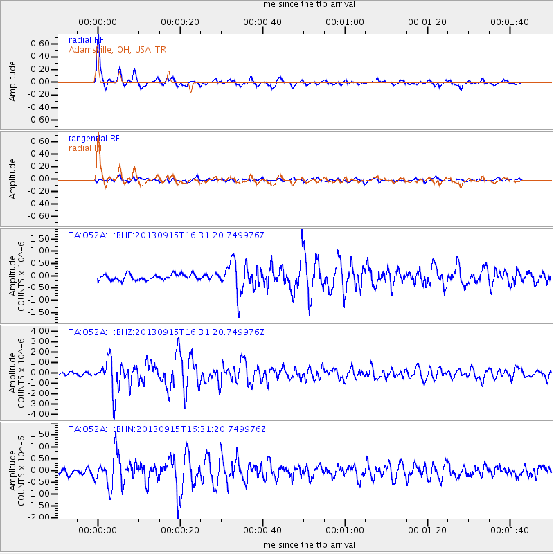
Earthquake location: Andreanof Islands, Aleutian Is.
Earthquake latitude/longitude: 51.6/-174.7
Earthquake time(UTC): 2013/09/15 (258) 16:21:37 GMT
Earthquake Depth: 24 km
Earthquake Magnitude: 6.1 MWW, 5.7 MI, 5.7 ML, 6.0 MWB, 6.1 MWC, 6.1 MWW
Earthquake Catalog/Contributor: NEIC PDE/NEIC COMCAT
Network: TA USArray Transportable Network (new EarthScope stations)
Station: O52A Adamsville, OH, USA
Lat/Lon: 40.12 N/81.84 W
Elevation: 331 m
Distance: 61.5 deg
Az: 60.654 deg
Baz: 314.819 deg
Ray Param: 0.060814366
Estimated Moho Depth: 31.75 km
Estimated Crust Vp/Vs: 2.05
Assumed Crust Vp: 6.483 km/s
Estimated Crust Vs: 3.162 km/s
Estimated Crust Poisson's Ratio: 0.34
Radial Match: 92.11275 %
Radial Bump: 367
Transverse Match: 72.58214 %
Transverse Bump: 400
SOD ConfigId: 626651
Insert Time: 2014-04-18 17:30:15.397 +0000
GWidth: 2.5
Max Bumps: 400
Tol: 0.001

Signal To Noise

ChannelStoNSTALTA
TA:O52A: :BHZ:20130915T16:31:20.749976Z12.4018911.6086852E-61.297129E-7
TA:O52A: :BHN:20130915T16:31:20.749976Z5.08662186.9463766E-71.3656168E-7
TA:O52A: :BHE:20130915T16:31:20.749976Z5.65842446.8211597E-71.2054875E-7
Arrivals
Ps5.4 SECOND
PpPs14 SECOND
PsPs/PpSs20 SECOND