O56A Blue Knob State Park, Imler, PA, USA - Earthquake Result Viewer
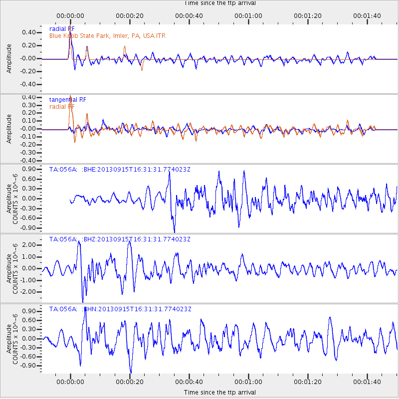
Earthquake location: Andreanof Islands, Aleutian Is.
Earthquake latitude/longitude: 51.6/-174.7
Earthquake time(UTC): 2013/09/15 (258) 16:21:37 GMT
Earthquake Depth: 24 km
Earthquake Magnitude: 6.1 MWW, 5.7 MI, 5.7 ML, 6.0 MWB, 6.1 MWC, 6.1 MWW
Earthquake Catalog/Contributor: NEIC PDE/NEIC COMCAT
Network: TA USArray Transportable Network (new EarthScope stations)
Station: O56A Blue Knob State Park, Imler, PA, USA
Lat/Lon: 40.27 N/78.57 W
Elevation: 684 m
Distance: 63.1 deg
Az: 58.52 deg
Baz: 315.93 deg
Ray Param: 0.05974347
Estimated Moho Depth: 41.25 km
Estimated Crust Vp/Vs: 1.80
Assumed Crust Vp: 6.121 km/s
Estimated Crust Vs: 3.41 km/s
Estimated Crust Poisson's Ratio: 0.27
Radial Match: 83.24274 %
Radial Bump: 400
Transverse Match: 72.923225 %
Transverse Bump: 400
SOD ConfigId: 626651
Insert Time: 2014-04-18 17:30:25.664 +0000
GWidth: 2.5
Max Bumps: 400
Tol: 0.001

Signal To Noise

ChannelStoNSTALTA
TA:O56A: :BHZ:20130915T16:31:31.774023Z5.21541.295939E-62.4848313E-7
TA:O56A: :BHN:20130915T16:31:31.774023Z2.5691553.98215E-71.5499843E-7
TA:O56A: :BHE:20130915T16:31:31.774023Z3.75118833.7684055E-71.00458976E-7
Arrivals
Ps5.6 SECOND
PpPs18 SECOND
PsPs/PpSs24 SECOND