P53A Whipple, OH, USA - Earthquake Result Viewer
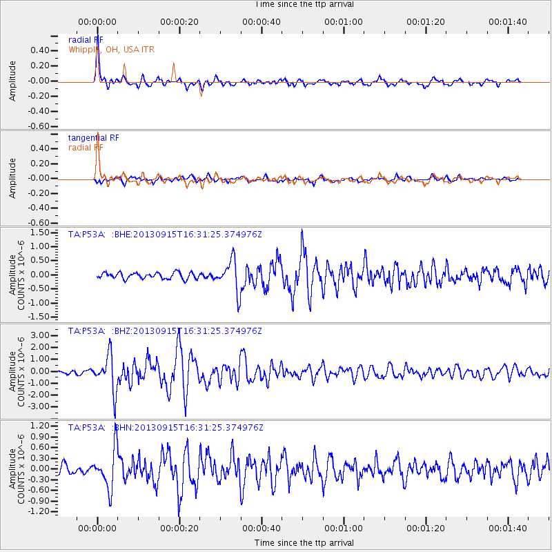
Earthquake location: Andreanof Islands, Aleutian Is.
Earthquake latitude/longitude: 51.6/-174.7
Earthquake time(UTC): 2013/09/15 (258) 16:21:37 GMT
Earthquake Depth: 24 km
Earthquake Magnitude: 6.1 MWW, 5.7 MI, 5.7 ML, 6.0 MWB, 6.1 MWC, 6.1 MWW
Earthquake Catalog/Contributor: NEIC PDE/NEIC COMCAT
Network: TA USArray Transportable Network (new EarthScope stations)
Station: P53A Whipple, OH, USA
Lat/Lon: 39.49 N/81.39 W
Elevation: 270 m
Distance: 62.2 deg
Az: 60.881 deg
Baz: 315.212 deg
Ray Param: 0.06037204
Estimated Moho Depth: 44.25 km
Estimated Crust Vp/Vs: 1.85
Assumed Crust Vp: 6.207 km/s
Estimated Crust Vs: 3.364 km/s
Estimated Crust Poisson's Ratio: 0.29
Radial Match: 89.2584 %
Radial Bump: 400
Transverse Match: 82.09519 %
Transverse Bump: 400
SOD ConfigId: 626651
Insert Time: 2014-04-18 17:30:56.279 +0000
GWidth: 2.5
Max Bumps: 400
Tol: 0.001

Signal To Noise

ChannelStoNSTALTA
TA:P53A: :BHZ:20130915T16:31:25.374976Z11.0459811.5536089E-61.4064925E-7
TA:P53A: :BHN:20130915T16:31:25.374976Z5.5149555.8465196E-71.060121E-7
TA:P53A: :BHE:20130915T16:31:25.374976Z5.43384655.8642456E-71.0792071E-7
Arrivals
Ps6.3 SECOND
PpPs19 SECOND
PsPs/PpSs26 SECOND