
P54A Burton, WV, USA - Earthquake Result Viewer
| ||||||||||||||||||
| ||||||||||||||||||
| ||||||||||||||||||
|
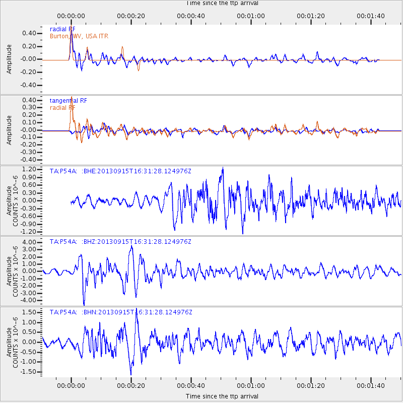
Signal To Noise
| Channel | StoN | STA | LTA |
| TA:P54A: :BHZ:20130915T16:31:28.124976Z | 9.327863 | 1.7906036E-6 | 1.919629E-7 |
| TA:P54A: :BHN:20130915T16:31:28.124976Z | 2.8434222 | 3.9219157E-7 | 1.379294E-7 |
| TA:P54A: :BHE:20130915T16:31:28.124976Z | 3.7013578 | 5.037834E-7 | 1.3610772E-7 |
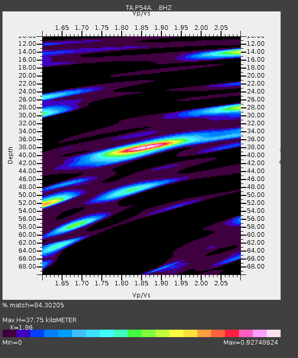
| Arrivals | |
| Ps | 5.4 SECOND |
| PpPs | 17 SECOND |
| PsPs/PpSs | 22 SECOND |

