P55A Reedsville, WV, USA - Earthquake Result Viewer
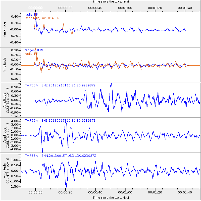
Earthquake location: Andreanof Islands, Aleutian Is.
Earthquake latitude/longitude: 51.6/-174.7
Earthquake time(UTC): 2013/09/15 (258) 16:21:37 GMT
Earthquake Depth: 24 km
Earthquake Magnitude: 6.1 MWW, 5.7 MI, 5.7 ML, 6.0 MWB, 6.1 MWC, 6.1 MWW
Earthquake Catalog/Contributor: NEIC PDE/NEIC COMCAT
Network: TA USArray Transportable Network (new EarthScope stations)
Station: P55A Reedsville, WV, USA
Lat/Lon: 39.51 N/79.83 W
Elevation: 551 m
Distance: 63.0 deg
Az: 59.893 deg
Baz: 315.747 deg
Ray Param: 0.059828013
Estimated Moho Depth: 14.5 km
Estimated Crust Vp/Vs: 2.07
Assumed Crust Vp: 6.159 km/s
Estimated Crust Vs: 2.975 km/s
Estimated Crust Poisson's Ratio: 0.35
Radial Match: 91.436966 %
Radial Bump: 400
Transverse Match: 75.813705 %
Transverse Bump: 400
SOD ConfigId: 626651
Insert Time: 2014-04-18 17:31:04.210 +0000
GWidth: 2.5
Max Bumps: 400
Tol: 0.001

Signal To Noise

ChannelStoNSTALTA
TA:P55A: :BHZ:20130915T16:31:30.923987Z11.2234251.8030605E-61.6065154E-7
TA:P55A: :BHN:20130915T16:31:30.923987Z2.91856363.18089E-71.089882E-7
TA:P55A: :BHE:20130915T16:31:30.923987Z3.54959273.359374E-79.464111E-8
Arrivals
Ps2.6 SECOND
PpPs7.0 SECOND
PsPs/PpSs9.6 SECOND