
P59A Jarrettsville, MD, USA - Earthquake Result Viewer
| ||||||||||||||||||
| ||||||||||||||||||
| ||||||||||||||||||
|
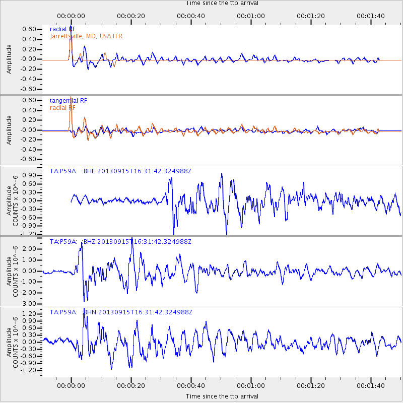
Signal To Noise
| Channel | StoN | STA | LTA |
| TA:P59A: :BHZ:20130915T16:31:42.324988Z | 7.1234646 | 1.2711423E-6 | 1.784444E-7 |
| TA:P59A: :BHN:20130915T16:31:42.324988Z | 3.7367873 | 5.0887644E-7 | 1.3618019E-7 |
| TA:P59A: :BHE:20130915T16:31:42.324988Z | 6.3304696 | 4.744577E-7 | 7.494826E-8 |
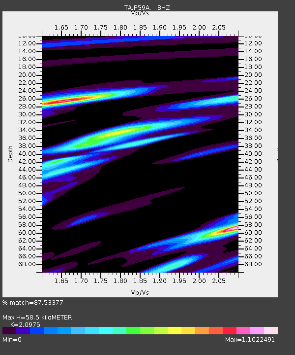
| Arrivals | |
| Ps | 10 SECOND |
| PpPs | 27 SECOND |
| PsPs/PpSs | 38 SECOND |

