
Q53A Leroy, WV, USA - Earthquake Result Viewer
| ||||||||||||||||||
| ||||||||||||||||||
| ||||||||||||||||||
|
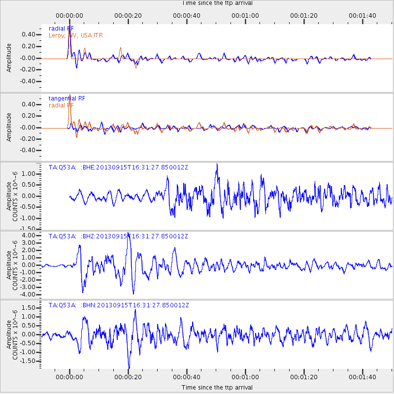
Signal To Noise
| Channel | StoN | STA | LTA |
| TA:Q53A: :BHZ:20130915T16:31:27.850012Z | 9.076918 | 1.5579832E-6 | 1.7164233E-7 |
| TA:Q53A: :BHN:20130915T16:31:27.850012Z | 3.9036262 | 4.764173E-7 | 1.2204481E-7 |
| TA:Q53A: :BHE:20130915T16:31:27.850012Z | 2.524605 | 4.0632068E-7 | 1.6094425E-7 |
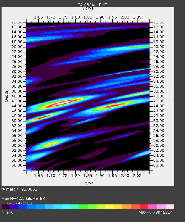
| Arrivals | |
| Ps | 5.3 SECOND |
| PpPs | 18 SECOND |
| PsPs/PpSs | 23 SECOND |

