Q59A Harwood, MD, USA - Earthquake Result Viewer
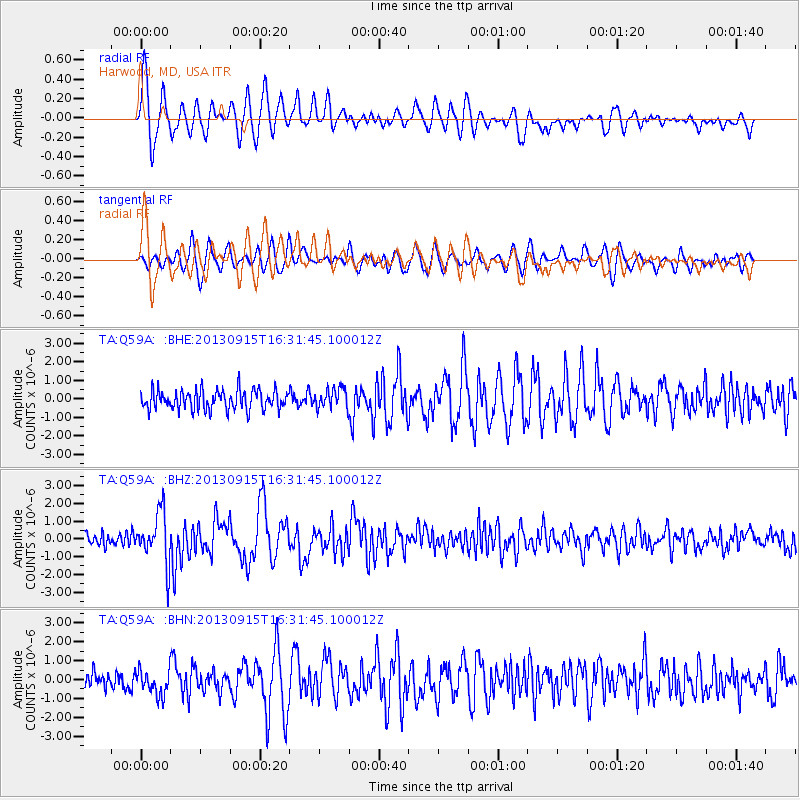
Earthquake location: Andreanof Islands, Aleutian Is.
Earthquake latitude/longitude: 51.6/-174.7
Earthquake time(UTC): 2013/09/15 (258) 16:21:37 GMT
Earthquake Depth: 24 km
Earthquake Magnitude: 6.1 MWW, 5.7 MI, 5.7 ML, 6.0 MWB, 6.1 MWC, 6.1 MWW
Earthquake Catalog/Contributor: NEIC PDE/NEIC COMCAT
Network: TA USArray Transportable Network (new EarthScope stations)
Station: Q59A Harwood, MD, USA
Lat/Lon: 38.86 N/76.65 W
Elevation: 34 m
Distance: 65.2 deg
Az: 58.401 deg
Baz: 317.091 deg
Ray Param: 0.058419198
Estimated Moho Depth: 40.0 km
Estimated Crust Vp/Vs: 1.60
Assumed Crust Vp: 6.419 km/s
Estimated Crust Vs: 4.012 km/s
Estimated Crust Poisson's Ratio: 0.18
Radial Match: 88.38106 %
Radial Bump: 400
Transverse Match: 75.067894 %
Transverse Bump: 400
SOD ConfigId: 626651
Insert Time: 2014-04-18 17:32:10.026 +0000
GWidth: 2.5
Max Bumps: 400
Tol: 0.001

Signal To Noise

ChannelStoNSTALTA
TA:Q59A: :BHZ:20130915T16:31:45.100012Z4.059991.4379838E-63.5418407E-7
TA:Q59A: :BHN:20130915T16:31:45.100012Z1.40998426.638109E-74.7079314E-7
TA:Q59A: :BHE:20130915T16:31:45.100012Z1.02158615.343685E-75.230773E-7
Arrivals
Ps3.9 SECOND
PpPs15 SECOND
PsPs/PpSs19 SECOND