R54A Victor, WV, USA - Earthquake Result Viewer
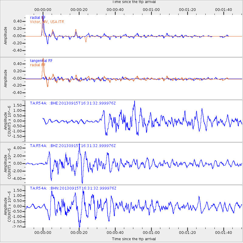
Earthquake location: Andreanof Islands, Aleutian Is.
Earthquake latitude/longitude: 51.6/-174.7
Earthquake time(UTC): 2013/09/15 (258) 16:21:37 GMT
Earthquake Depth: 24 km
Earthquake Magnitude: 6.1 MWW, 5.7 MI, 5.7 ML, 6.0 MWB, 6.1 MWC, 6.1 MWW
Earthquake Catalog/Contributor: NEIC PDE/NEIC COMCAT
Network: TA USArray Transportable Network (new EarthScope stations)
Station: R54A Victor, WV, USA
Lat/Lon: 38.18 N/80.99 W
Elevation: 512 m
Distance: 63.3 deg
Az: 61.659 deg
Baz: 315.817 deg
Ray Param: 0.059623703
Estimated Moho Depth: 13.75 km
Estimated Crust Vp/Vs: 1.82
Assumed Crust Vp: 6.207 km/s
Estimated Crust Vs: 3.406 km/s
Estimated Crust Poisson's Ratio: 0.28
Radial Match: 94.49039 %
Radial Bump: 369
Transverse Match: 79.44475 %
Transverse Bump: 400
SOD ConfigId: 626651
Insert Time: 2014-04-18 17:32:38.257 +0000
GWidth: 2.5
Max Bumps: 400
Tol: 0.001

Signal To Noise

ChannelStoNSTALTA
TA:R54A: :BHZ:20130915T16:31:32.999976Z12.8151131.7472247E-61.3634096E-7
TA:R54A: :BHN:20130915T16:31:32.999976Z4.9577455.983417E-71.2068828E-7
TA:R54A: :BHE:20130915T16:31:32.999976Z4.50161085.0825736E-71.1290567E-7
Arrivals
Ps1.9 SECOND
PpPs6.0 SECOND
PsPs/PpSs7.9 SECOND