S51A Beattyville, KY, USA - Earthquake Result Viewer
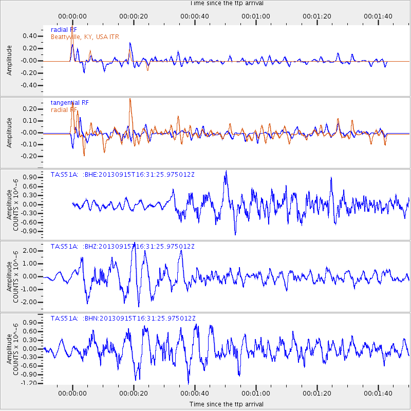
Earthquake location: Andreanof Islands, Aleutian Is.
Earthquake latitude/longitude: 51.6/-174.7
Earthquake time(UTC): 2013/09/15 (258) 16:21:37 GMT
Earthquake Depth: 24 km
Earthquake Magnitude: 6.1 MWW, 5.7 MI, 5.7 ML, 6.0 MWB, 6.1 MWC, 6.1 MWW
Earthquake Catalog/Contributor: NEIC PDE/NEIC COMCAT
Network: TA USArray Transportable Network (new EarthScope stations)
Station: S51A Beattyville, KY, USA
Lat/Lon: 37.64 N/83.59 W
Elevation: 286 m
Distance: 62.3 deg
Az: 63.736 deg
Baz: 315.174 deg
Ray Param: 0.060311757
Estimated Moho Depth: 45.25 km
Estimated Crust Vp/Vs: 1.83
Assumed Crust Vp: 6.476 km/s
Estimated Crust Vs: 3.544 km/s
Estimated Crust Poisson's Ratio: 0.29
Radial Match: 82.95144 %
Radial Bump: 400
Transverse Match: 86.24393 %
Transverse Bump: 400
SOD ConfigId: 626651
Insert Time: 2014-04-18 17:33:21.777 +0000
GWidth: 2.5
Max Bumps: 400
Tol: 0.001

Signal To Noise

ChannelStoNSTALTA
TA:S51A: :BHZ:20130915T16:31:25.975012Z5.57809268.2900425E-71.4861787E-7
TA:S51A: :BHN:20130915T16:31:25.975012Z1.08282211.5296851E-71.4126837E-7
TA:S51A: :BHE:20130915T16:31:25.975012Z2.18351962.2318268E-71.0221236E-7
Arrivals
Ps6.0 SECOND
PpPs19 SECOND
PsPs/PpSs25 SECOND