
S53A Williamson, WV, USA - Earthquake Result Viewer
| ||||||||||||||||||
| ||||||||||||||||||
| ||||||||||||||||||
|
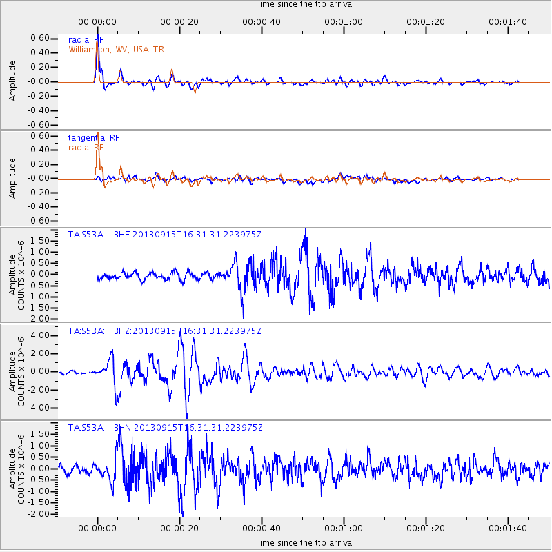
Signal To Noise
| Channel | StoN | STA | LTA |
| TA:S53A: :BHZ:20130915T16:31:31.223975Z | 10.335515 | 1.3990106E-6 | 1.3535954E-7 |
| TA:S53A: :BHN:20130915T16:31:31.223975Z | 3.6750114 | 4.7537503E-7 | 1.2935335E-7 |
| TA:S53A: :BHE:20130915T16:31:31.223975Z | 2.6582253 | 3.9851724E-7 | 1.4991855E-7 |
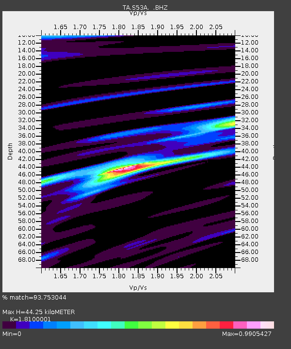
| Arrivals | |
| Ps | 5.8 SECOND |
| PpPs | 18 SECOND |
| PsPs/PpSs | 24 SECOND |

