
SFIN Lafayette, IN, USA - Earthquake Result Viewer
| ||||||||||||||||||
| ||||||||||||||||||
| ||||||||||||||||||
|
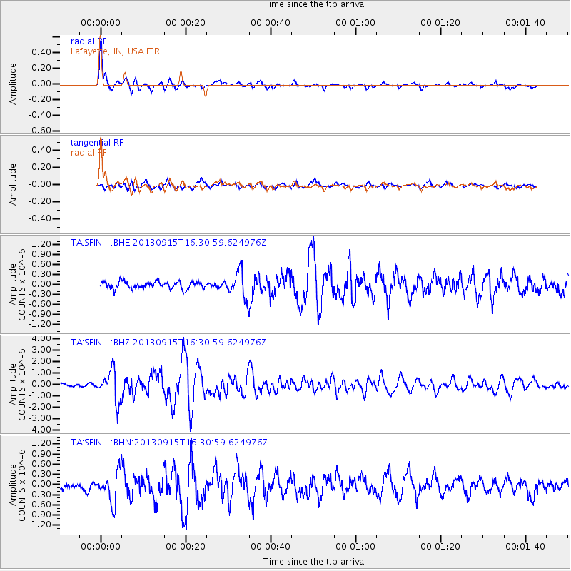
Signal To Noise
| Channel | StoN | STA | LTA |
| TA:SFIN: :BHZ:20130915T16:30:59.624976Z | 8.834951 | 1.358188E-6 | 1.5372899E-7 |
| TA:SFIN: :BHN:20130915T16:30:59.624976Z | 3.6155531 | 4.626249E-7 | 1.2795411E-7 |
| TA:SFIN: :BHE:20130915T16:30:59.624976Z | 3.9537406 | 4.015692E-7 | 1.015669E-7 |
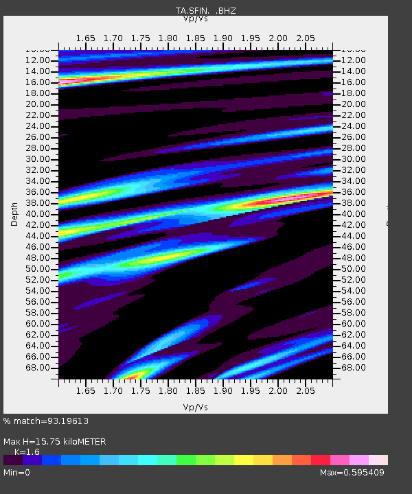
| Arrivals | |
| Ps | 1.5 SECOND |
| PpPs | 6.0 SECOND |
| PsPs/PpSs | 7.5 SECOND |

