
T25A Trinidad, CO, USA - Earthquake Result Viewer
| ||||||||||||||||||
| ||||||||||||||||||
| ||||||||||||||||||
|
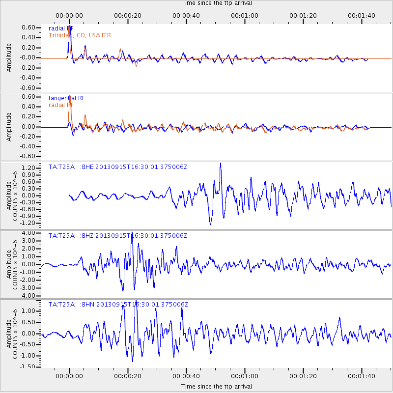
Signal To Noise
| Channel | StoN | STA | LTA |
| TA:T25A: :BHZ:20130915T16:30:01.375006Z | 3.423717 | 3.800847E-7 | 1.11015225E-7 |
| TA:T25A: :BHN:20130915T16:30:01.375006Z | 2.05709 | 1.6808006E-7 | 8.170768E-8 |
| TA:T25A: :BHE:20130915T16:30:01.375006Z | 1.8115895 | 1.657178E-7 | 9.147646E-8 |
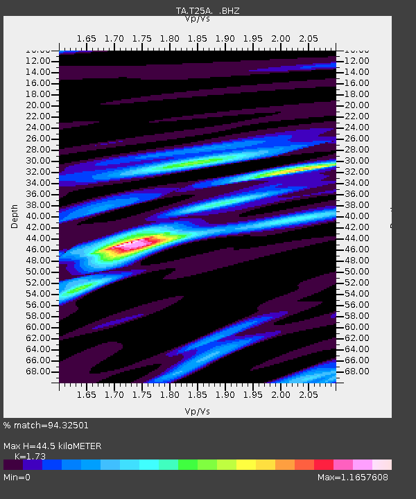
| Arrivals | |
| Ps | 5.4 SECOND |
| PpPs | 18 SECOND |
| PsPs/PpSs | 24 SECOND |

