
T47A Sharon Grove, KY, USA - Earthquake Result Viewer
| ||||||||||||||||||
| ||||||||||||||||||
| ||||||||||||||||||
|
Signal To Noise
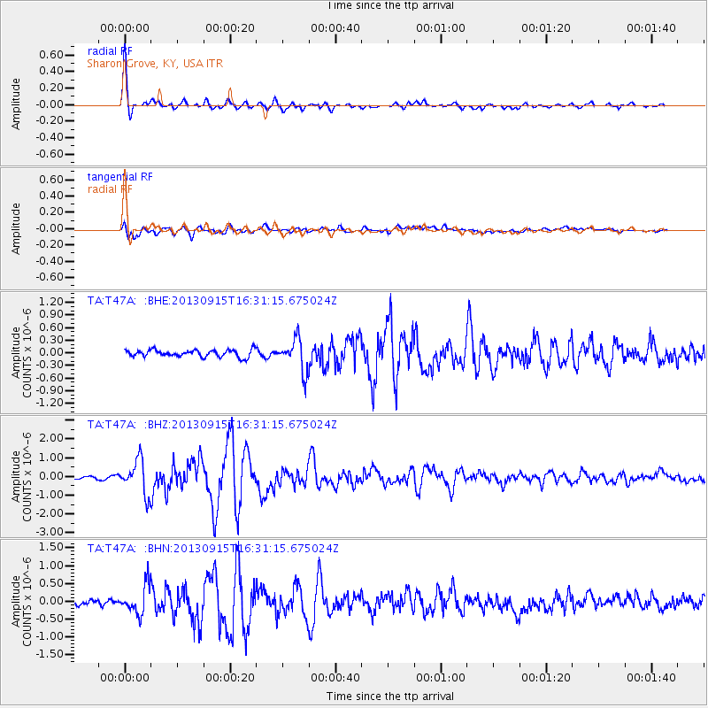
| Channel | StoN | STA | LTA |
| TA:T47A: :BHZ:20130915T16:31:15.675024Z | 12.421733 | 9.17541E-7 | 7.3865785E-8 |
| TA:T47A: :BHN:20130915T16:31:15.675024Z | 7.333931 | 4.063485E-7 | 5.5406645E-8 |
| TA:T47A: :BHE:20130915T16:31:15.675024Z | 4.654095 | 3.909255E-7 | 8.399602E-8 |
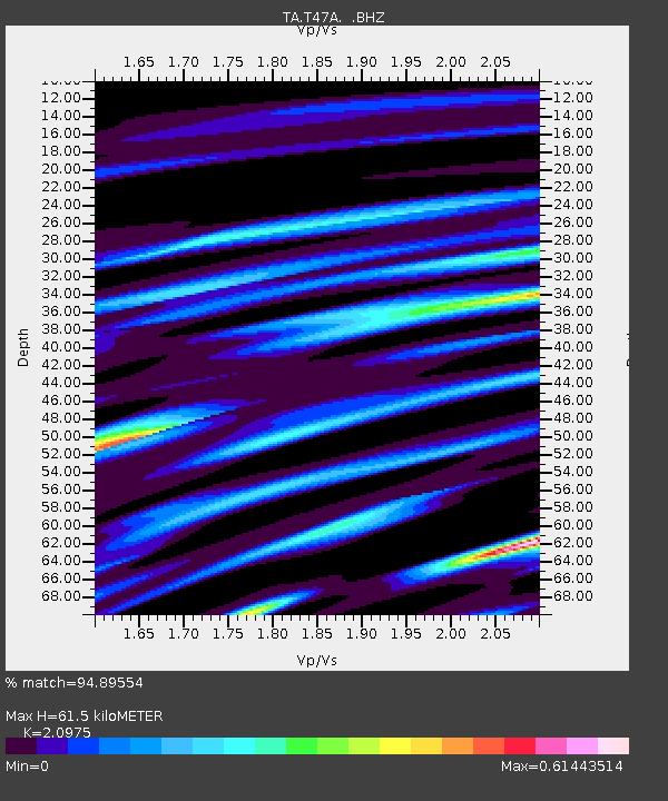
| Arrivals | |
| Ps | 11 SECOND |
| PpPs | 28 SECOND |
| PsPs/PpSs | 39 SECOND |

