T49A Edmonton, KY, USA - Earthquake Result Viewer
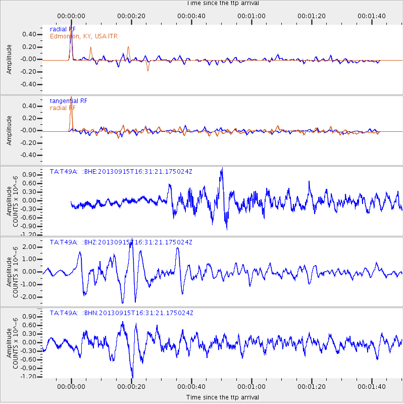
Earthquake location: Andreanof Islands, Aleutian Is.
Earthquake latitude/longitude: 51.6/-174.7
Earthquake time(UTC): 2013/09/15 (258) 16:21:37 GMT
Earthquake Depth: 24 km
Earthquake Magnitude: 6.1 MWW, 5.7 MI, 5.7 ML, 6.0 MWB, 6.1 MWC, 6.1 MWW
Earthquake Catalog/Contributor: NEIC PDE/NEIC COMCAT
Network: TA USArray Transportable Network (new EarthScope stations)
Station: T49A Edmonton, KY, USA
Lat/Lon: 37.10 N/85.53 W
Elevation: 313 m
Distance: 61.5 deg
Az: 65.402 deg
Baz: 314.786 deg
Ray Param: 0.06077496
Estimated Moho Depth: 25.0 km
Estimated Crust Vp/Vs: 2.09
Assumed Crust Vp: 6.476 km/s
Estimated Crust Vs: 3.099 km/s
Estimated Crust Poisson's Ratio: 0.35
Radial Match: 88.53939 %
Radial Bump: 400
Transverse Match: 73.35775 %
Transverse Bump: 400
SOD ConfigId: 626651
Insert Time: 2014-04-18 17:34:13.249 +0000
GWidth: 2.5
Max Bumps: 400
Tol: 0.001

Signal To Noise

ChannelStoNSTALTA
TA:T49A: :BHZ:20130915T16:31:21.175024Z5.97090539.76388E-71.6352428E-7
TA:T49A: :BHN:20130915T16:31:21.175024Z1.84807292.5553604E-71.3827162E-7
TA:T49A: :BHE:20130915T16:31:21.175024Z3.05933243.0463218E-79.957473E-8
Arrivals
Ps4.4 SECOND
PpPs11 SECOND
PsPs/PpSs16 SECOND