T50A Nancy, KY, USA - Earthquake Result Viewer
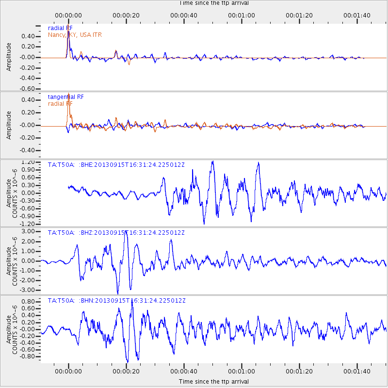
Earthquake location: Andreanof Islands, Aleutian Is.
Earthquake latitude/longitude: 51.6/-174.7
Earthquake time(UTC): 2013/09/15 (258) 16:21:37 GMT
Earthquake Depth: 24 km
Earthquake Magnitude: 6.1 MWW, 5.7 MI, 5.7 ML, 6.0 MWB, 6.1 MWC, 6.1 MWW
Earthquake Catalog/Contributor: NEIC PDE/NEIC COMCAT
Network: TA USArray Transportable Network (new EarthScope stations)
Station: T50A Nancy, KY, USA
Lat/Lon: 37.02 N/84.84 W
Elevation: 302 m
Distance: 62.0 deg
Az: 65.025 deg
Baz: 315.025 deg
Ray Param: 0.060485817
Estimated Moho Depth: 11.0 km
Estimated Crust Vp/Vs: 1.61
Assumed Crust Vp: 6.476 km/s
Estimated Crust Vs: 4.029 km/s
Estimated Crust Poisson's Ratio: 0.18
Radial Match: 97.07143 %
Radial Bump: 348
Transverse Match: 80.34892 %
Transverse Bump: 400
SOD ConfigId: 626651
Insert Time: 2014-04-18 17:34:14.427 +0000
GWidth: 2.5
Max Bumps: 400
Tol: 0.001

Signal To Noise

ChannelStoNSTALTA
TA:T50A: :BHZ:20130915T16:31:24.225012Z9.4208119.873615E-71.04806425E-7
TA:T50A: :BHN:20130915T16:31:24.225012Z3.26662022.0774101E-76.3595095E-8
TA:T50A: :BHE:20130915T16:31:24.225012Z2.57795883.1259896E-71.2125831E-7
Arrivals
Ps1.1 SECOND
PpPs4.2 SECOND
PsPs/PpSs5.3 SECOND