T52A Hallie, KY, USA - Earthquake Result Viewer
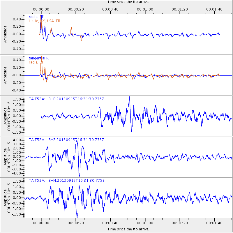
Earthquake location: Andreanof Islands, Aleutian Is.
Earthquake latitude/longitude: 51.6/-174.7
Earthquake time(UTC): 2013/09/15 (258) 16:21:37 GMT
Earthquake Depth: 24 km
Earthquake Magnitude: 6.1 MWW, 5.7 MI, 5.7 ML, 6.0 MWB, 6.1 MWC, 6.1 MWW
Earthquake Catalog/Contributor: NEIC PDE/NEIC COMCAT
Network: TA USArray Transportable Network (new EarthScope stations)
Station: T52A Hallie, KY, USA
Lat/Lon: 37.11 N/82.99 W
Elevation: 436 m
Distance: 63.0 deg
Az: 63.768 deg
Baz: 315.556 deg
Ray Param: 0.0598435
Estimated Moho Depth: 12.75 km
Estimated Crust Vp/Vs: 2.05
Assumed Crust Vp: 6.476 km/s
Estimated Crust Vs: 3.167 km/s
Estimated Crust Poisson's Ratio: 0.34
Radial Match: 94.20302 %
Radial Bump: 375
Transverse Match: 82.305176 %
Transverse Bump: 400
SOD ConfigId: 626651
Insert Time: 2014-04-18 17:34:19.340 +0000
GWidth: 2.5
Max Bumps: 400
Tol: 0.001

Signal To Noise

ChannelStoNSTALTA
TA:T52A: :BHZ:20130915T16:31:30.775Z15.0392751.2795343E-68.507952E-8
TA:T52A: :BHN:20130915T16:31:30.775Z4.5388423.579744E-77.886909E-8
TA:T52A: :BHE:20130915T16:31:30.775Z2.97582083.494345E-71.1742458E-7
Arrivals
Ps2.1 SECOND
PpPs5.8 SECOND
PsPs/PpSs7.9 SECOND