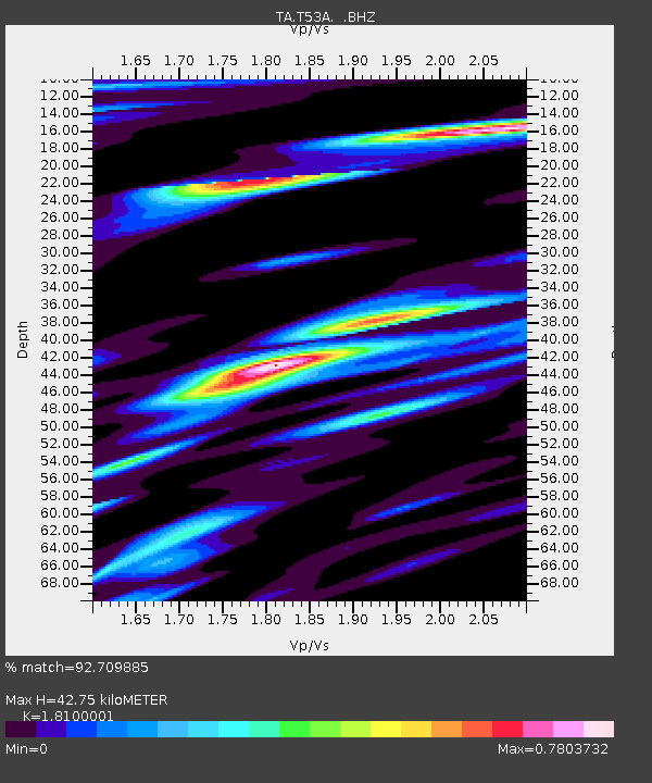
T53A Wise, VA, USA - Earthquake Result Viewer
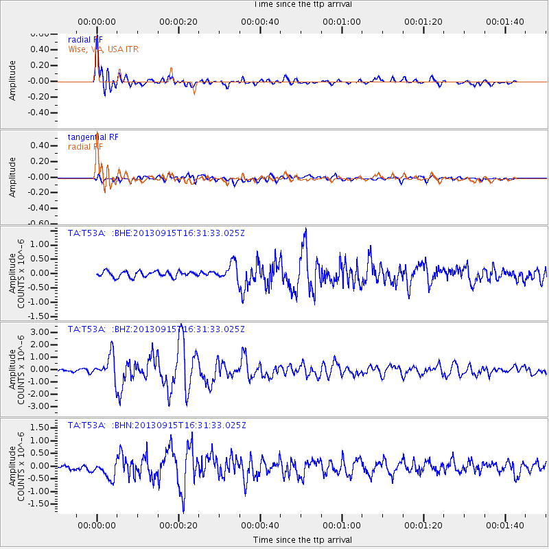
Earthquake location: Andreanof Islands, Aleutian Is.
Earthquake latitude/longitude: 51.6/-174.7
Earthquake time(UTC): 2013/09/15 (258) 16:21:37 GMT
Earthquake Depth: 24 km
Earthquake Magnitude: 6.1 MWW, 5.7 MI, 5.7 ML, 6.0 MWB, 6.1 MWC, 6.1 MWW
Earthquake Catalog/Contributor: NEIC PDE/NEIC COMCAT
Network: TA USArray Transportable Network (new EarthScope stations)
Station: T53A Wise, VA, USA
Lat/Lon: 36.98 N/82.54 W
Elevation: 818 m
Distance: 63.3 deg
Az: 63.577 deg
Baz: 315.74 deg
Ray Param: 0.059622675
Estimated Moho Depth: 42.75 km
Estimated Crust Vp/Vs: 1.81
Assumed Crust Vp: 6.476 km/s
Estimated Crust Vs: 3.578 km/s
Estimated Crust Poisson's Ratio: 0.28
Radial Match: 92.709885 %
Radial Bump: 400
Transverse Match: 77.10206 %
Transverse Bump: 400
SOD ConfigId: 626651
Insert Time: 2014-04-18 17:34:23.239 +0000
GWidth: 2.5
Max Bumps: 400
Tol: 0.001

Signal To Noise

ChannelStoNSTALTA
TA:T53A: :BHZ:20130915T16:31:33.025Z7.7740291.0244619E-61.3178006E-7
TA:T53A: :BHN:20130915T16:31:33.025Z3.7653453.5598006E-79.454115E-8
TA:T53A: :BHE:20130915T16:31:33.025Z3.05813743.057088E-79.9965675E-8
Arrivals
Ps5.6 SECOND
PpPs18 SECOND
PsPs/PpSs23 SECOND