
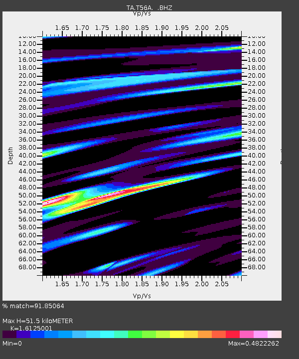
T56A Rocky Mt, VA, USA - Earthquake Result Viewer
| ||||||||||||||||||
| ||||||||||||||||||
| ||||||||||||||||||
|
Signal To Noise
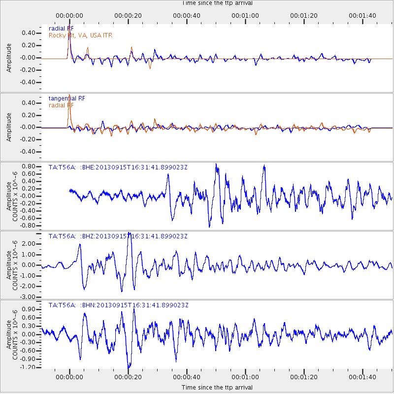
| Channel | StoN | STA | LTA |
| TA:T56A: :BHZ:20130915T16:31:41.899023Z | 5.2549634 | 9.714228E-7 | 1.8485814E-7 |
| TA:T56A: :BHN:20130915T16:31:41.899023Z | 3.342025 | 3.7678967E-7 | 1.12742924E-7 |
| TA:T56A: :BHE:20130915T16:31:41.899023Z | 2.9648626 | 2.3350024E-7 | 7.875584E-8 |
| Arrivals | |
| Ps | 5.3 SECOND |
| PpPs | 21 SECOND |
| PsPs/PpSs | 26 SECOND |

