T59A Double 'B' Farms, VA, USA - Earthquake Result Viewer
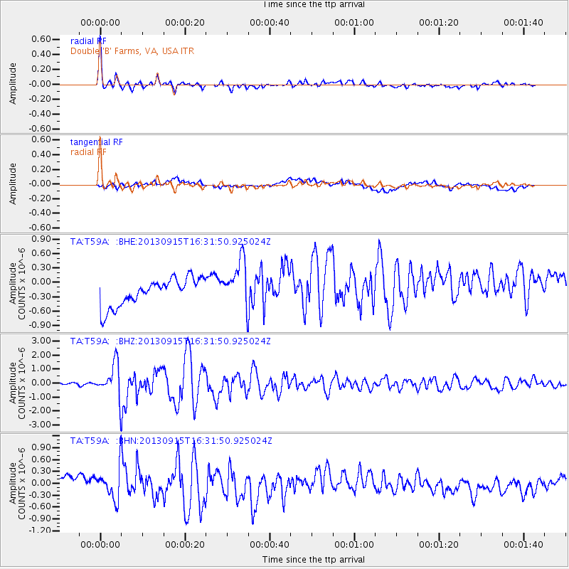
Earthquake location: Andreanof Islands, Aleutian Is.
Earthquake latitude/longitude: 51.6/-174.7
Earthquake time(UTC): 2013/09/15 (258) 16:21:37 GMT
Earthquake Depth: 24 km
Earthquake Magnitude: 6.1 MWW, 5.7 MI, 5.7 ML, 6.0 MWB, 6.1 MWC, 6.1 MWW
Earthquake Catalog/Contributor: NEIC PDE/NEIC COMCAT
Network: TA USArray Transportable Network (new EarthScope stations)
Station: T59A Double 'B' Farms, VA, USA
Lat/Lon: 36.97 N/77.55 W
Elevation: 63 m
Distance: 66.1 deg
Az: 60.383 deg
Baz: 317.359 deg
Ray Param: 0.05782625
Estimated Moho Depth: 34.75 km
Estimated Crust Vp/Vs: 1.72
Assumed Crust Vp: 6.565 km/s
Estimated Crust Vs: 3.828 km/s
Estimated Crust Poisson's Ratio: 0.24
Radial Match: 90.51562 %
Radial Bump: 400
Transverse Match: 21.034483 %
Transverse Bump: 400
SOD ConfigId: 626651
Insert Time: 2014-04-18 17:34:37.948 +0000
GWidth: 2.5
Max Bumps: 400
Tol: 0.001

Signal To Noise

ChannelStoNSTALTA
TA:T59A: :BHZ:20130915T16:31:50.925024Z15.1174871.2253984E-68.105834E-8
TA:T59A: :BHN:20130915T16:31:50.925024Z0.86262184.2133513E-74.8843555E-7
TA:T59A: :BHE:20130915T16:31:50.925024Z1.78784945.1003775E-72.8528004E-7
Arrivals
Ps4.0 SECOND
PpPs14 SECOND
PsPs/PpSs18 SECOND