U51A La Follette, TN, USA - Earthquake Result Viewer
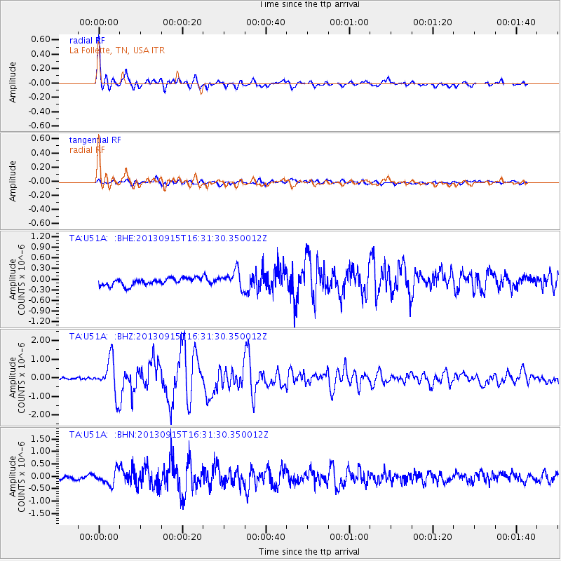
Earthquake location: Andreanof Islands, Aleutian Is.
Earthquake latitude/longitude: 51.6/-174.7
Earthquake time(UTC): 2013/09/15 (258) 16:21:37 GMT
Earthquake Depth: 24 km
Earthquake Magnitude: 6.1 MWW, 5.7 MI, 5.7 ML, 6.0 MWB, 6.1 MWC, 6.1 MWW
Earthquake Catalog/Contributor: NEIC PDE/NEIC COMCAT
Network: TA USArray Transportable Network (new EarthScope stations)
Station: U51A La Follette, TN, USA
Lat/Lon: 36.38 N/84.02 W
Elevation: 472 m
Distance: 62.9 deg
Az: 65.004 deg
Baz: 315.504 deg
Ray Param: 0.059883043
Estimated Moho Depth: 17.0 km
Estimated Crust Vp/Vs: 1.65
Assumed Crust Vp: 6.476 km/s
Estimated Crust Vs: 3.913 km/s
Estimated Crust Poisson's Ratio: 0.21
Radial Match: 90.4731 %
Radial Bump: 400
Transverse Match: 71.324165 %
Transverse Bump: 400
SOD ConfigId: 626651
Insert Time: 2014-04-18 17:34:56.864 +0000
GWidth: 2.5
Max Bumps: 400
Tol: 0.001

Signal To Noise

ChannelStoNSTALTA
TA:U51A: :BHZ:20130915T16:31:30.350012Z12.3727429.828167E-77.943403E-8
TA:U51A: :BHN:20130915T16:31:30.350012Z3.14569022.791077E-78.872701E-8
TA:U51A: :BHE:20130915T16:31:30.350012Z2.6009972.5875377E-79.9482534E-8
Arrivals
Ps1.8 SECOND
PpPs6.6 SECOND
PsPs/PpSs8.4 SECOND