U53A Fall Branch, TN, USA - Earthquake Result Viewer
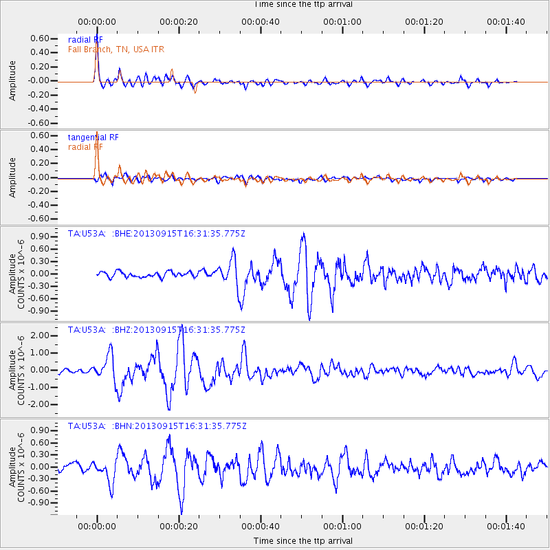
Earthquake location: Andreanof Islands, Aleutian Is.
Earthquake latitude/longitude: 51.6/-174.7
Earthquake time(UTC): 2013/09/15 (258) 16:21:37 GMT
Earthquake Depth: 24 km
Earthquake Magnitude: 6.1 MWW, 5.7 MI, 5.7 ML, 6.0 MWB, 6.1 MWC, 6.1 MWW
Earthquake Catalog/Contributor: NEIC PDE/NEIC COMCAT
Network: TA USArray Transportable Network (new EarthScope stations)
Station: U53A Fall Branch, TN, USA
Lat/Lon: 36.36 N/82.58 W
Elevation: 559 m
Distance: 63.7 deg
Az: 64.084 deg
Baz: 315.942 deg
Ray Param: 0.059350014
Estimated Moho Depth: 44.75 km
Estimated Crust Vp/Vs: 1.77
Assumed Crust Vp: 6.476 km/s
Estimated Crust Vs: 3.659 km/s
Estimated Crust Poisson's Ratio: 0.27
Radial Match: 92.93083 %
Radial Bump: 400
Transverse Match: 79.90596 %
Transverse Bump: 400
SOD ConfigId: 626651
Insert Time: 2014-04-18 17:35:06.009 +0000
GWidth: 2.5
Max Bumps: 400
Tol: 0.001

Signal To Noise

ChannelStoNSTALTA
TA:U53A: :BHZ:20130915T16:31:35.775Z9.0940037.6309266E-78.391164E-8
TA:U53A: :BHN:20130915T16:31:35.775Z3.429192.9235883E-78.525595E-8
TA:U53A: :BHE:20130915T16:31:35.775Z5.06365873.2447073E-76.4078314E-8
Arrivals
Ps5.6 SECOND
PpPs18 SECOND
PsPs/PpSs24 SECOND