
U55A TA2, Sparta, NC, USA - Earthquake Result Viewer
| ||||||||||||||||||
| ||||||||||||||||||
| ||||||||||||||||||
|
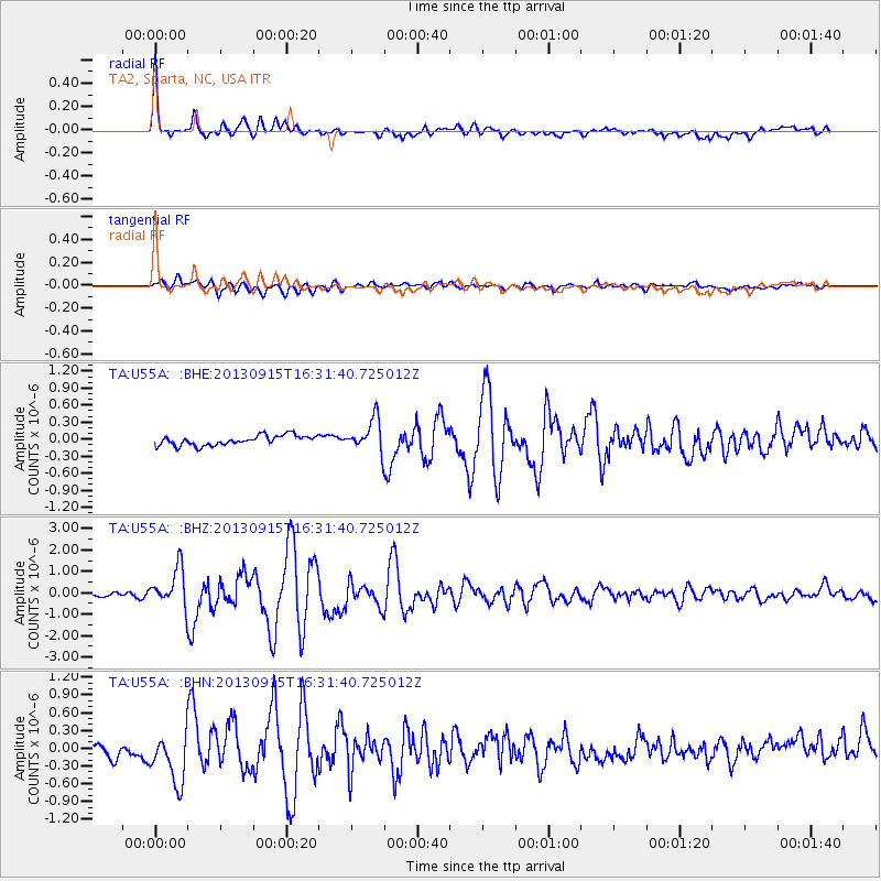
Signal To Noise
| Channel | StoN | STA | LTA |
| TA:U55A: :BHZ:20130915T16:31:40.725012Z | 12.105874 | 8.9033966E-7 | 7.354609E-8 |
| TA:U55A: :BHN:20130915T16:31:40.725012Z | 3.65769 | 4.1700056E-7 | 1.1400653E-7 |
| TA:U55A: :BHE:20130915T16:31:40.725012Z | 3.254712 | 2.846859E-7 | 8.746885E-8 |
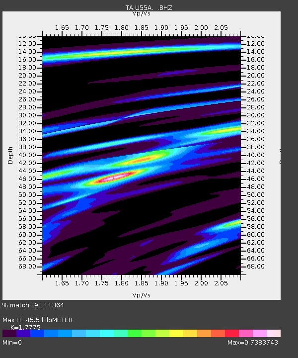
| Arrivals | |
| Ps | 6.0 SECOND |
| PpPs | 20 SECOND |
| PsPs/PpSs | 26 SECOND |

