U58A Oxford, NC, USA - Earthquake Result Viewer
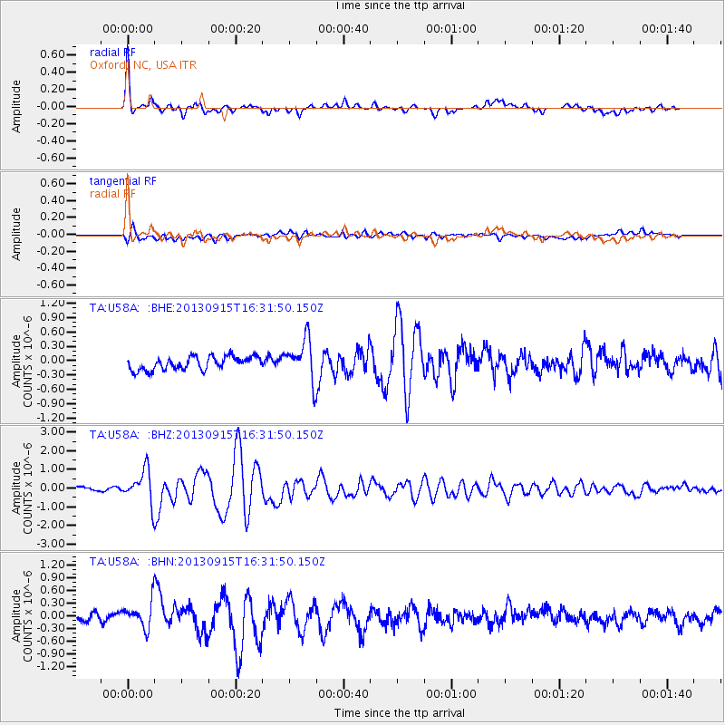
Earthquake location: Andreanof Islands, Aleutian Is.
Earthquake latitude/longitude: 51.6/-174.7
Earthquake time(UTC): 2013/09/15 (258) 16:21:37 GMT
Earthquake Depth: 24 km
Earthquake Magnitude: 6.1 MWW, 5.7 MI, 5.7 ML, 6.0 MWB, 6.1 MWC, 6.1 MWW
Earthquake Catalog/Contributor: NEIC PDE/NEIC COMCAT
Network: TA USArray Transportable Network (new EarthScope stations)
Station: U58A Oxford, NC, USA
Lat/Lon: 36.39 N/78.55 W
Elevation: 169 m
Distance: 66.0 deg
Az: 61.454 deg
Baz: 317.202 deg
Ray Param: 0.057904392
Estimated Moho Depth: 28.25 km
Estimated Crust Vp/Vs: 1.96
Assumed Crust Vp: 6.419 km/s
Estimated Crust Vs: 3.271 km/s
Estimated Crust Poisson's Ratio: 0.32
Radial Match: 89.59544 %
Radial Bump: 400
Transverse Match: 73.89802 %
Transverse Bump: 400
SOD ConfigId: 626651
Insert Time: 2014-04-18 17:35:19.233 +0000
GWidth: 2.5
Max Bumps: 400
Tol: 0.001

Signal To Noise

ChannelStoNSTALTA
TA:U58A: :BHZ:20130915T16:31:50.150Z8.1846138.9323447E-71.09135826E-7
TA:U58A: :BHN:20130915T16:31:50.150Z2.73095233.1140922E-71.1402953E-7
TA:U58A: :BHE:20130915T16:31:50.150Z3.18866354.3478323E-71.3635281E-7
Arrivals
Ps4.4 SECOND
PpPs13 SECOND
PsPs/PpSs17 SECOND