
U59A Littleton, NC, USA - Earthquake Result Viewer
| ||||||||||||||||||
| ||||||||||||||||||
| ||||||||||||||||||
|
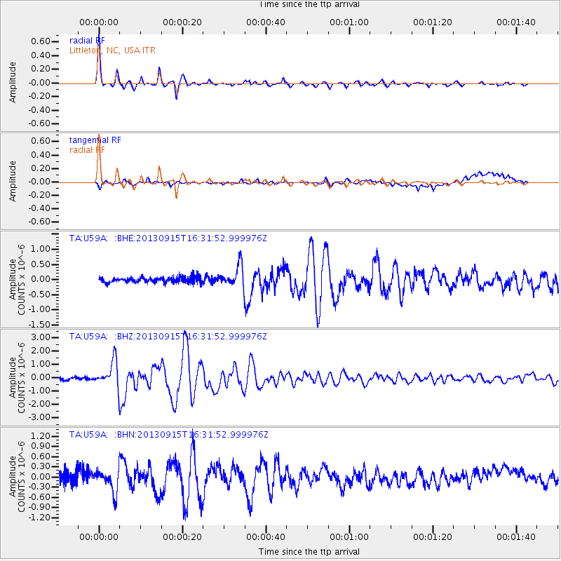
Signal To Noise
| Channel | StoN | STA | LTA |
| TA:U59A: :BHZ:20130915T16:31:52.999976Z | 10.565264 | 1.003533E-6 | 9.4984195E-8 |
| TA:U59A: :BHN:20130915T16:31:52.999976Z | 2.4574347 | 3.2352233E-7 | 1.3165042E-7 |
| TA:U59A: :BHE:20130915T16:31:52.999976Z | 3.8640823 | 3.5645337E-7 | 9.224787E-8 |
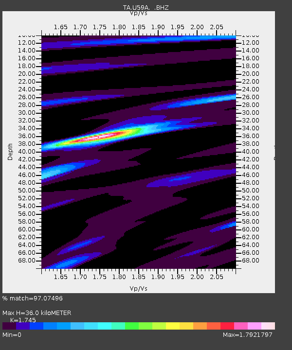
| Arrivals | |
| Ps | 4.3 SECOND |
| PpPs | 14 SECOND |
| PsPs/PpSs | 19 SECOND |

