
V49A McMinnville, TN, USA - Earthquake Result Viewer
| ||||||||||||||||||
| ||||||||||||||||||
| ||||||||||||||||||
|
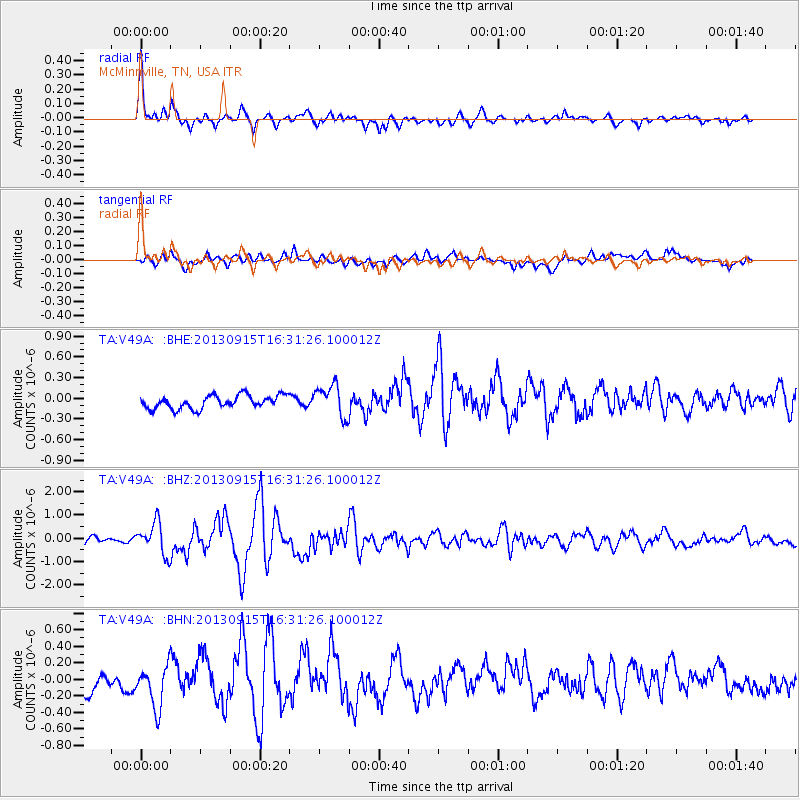
Signal To Noise
| Channel | StoN | STA | LTA |
| TA:V49A: :BHZ:20130915T16:31:26.100012Z | 4.7732067 | 6.769295E-7 | 1.418186E-7 |
| TA:V49A: :BHN:20130915T16:31:26.100012Z | 2.2583055 | 2.5925803E-7 | 1.14802006E-7 |
| TA:V49A: :BHE:20130915T16:31:26.100012Z | 2.40482 | 2.2941734E-7 | 9.539897E-8 |
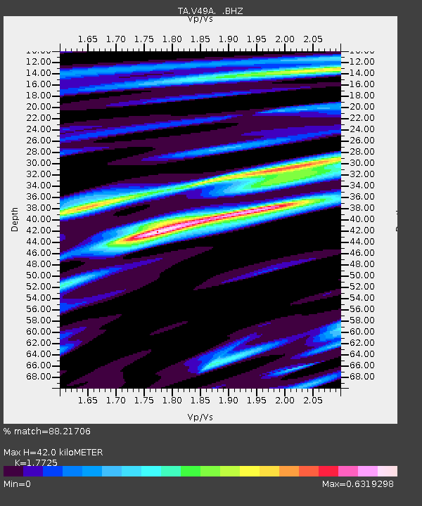
| Arrivals | |
| Ps | 5.3 SECOND |
| PpPs | 18 SECOND |
| PsPs/PpSs | 23 SECOND |

