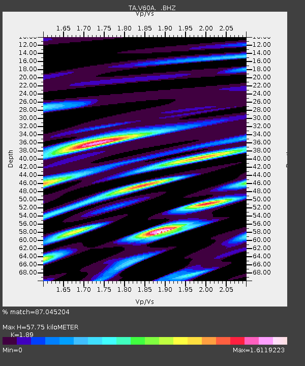
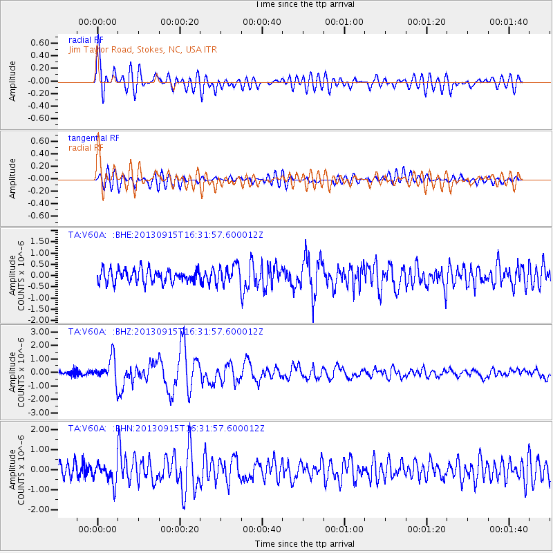
V60A Jim Taylor Road, Stokes, NC, USA - Earthquake Result Viewer

Earthquake location: Andreanof Islands, Aleutian Is.
Earthquake latitude/longitude: 51.6/-174.7
Earthquake time(UTC): 2013/09/15 (258) 16:21:37 GMT
Earthquake Depth: 24 km
Earthquake Magnitude: 6.1 MWW, 5.7 MI, 5.7 ML, 6.0 MWB, 6.1 MWC, 6.1 MWW
Earthquake Catalog/Contributor: NEIC PDE/NEIC COMCAT
Network: TA USArray Transportable Network (new EarthScope stations)
Station: V60A Jim Taylor Road, Stokes, NC, USA
Lat/Lon: 35.76 N/77.26 W
Elevation: 8.0 m
Distance: 67.1 deg
Az: 61.079 deg
Baz: 317.807 deg
Ray Param: 0.057134967
Estimated Moho Depth: 57.75 km
Estimated Crust Vp/Vs: 1.89
Assumed Crust Vp: 6.565 km/s
Estimated Crust Vs: 3.473 km/s
Estimated Crust Poisson's Ratio: 0.31
Radial Match: 87.045204 %
Radial Bump: 400
Transverse Match: 68.18907 %
Transverse Bump: 400
SOD ConfigId: 626651
Insert Time: 2014-04-18 17:36:07.599 +0000
GWidth: 2.5
Max Bumps: 400
Tol: 0.001

Signal To Noise

ChannelStoNSTALTA
TA:V60A: :BHZ:20130915T16:31:57.600012Z6.6270559.2119654E-71.3900541E-7
TA:V60A: :BHN:20130915T16:31:57.600012Z1.80404875.152149E-72.8558813E-7
TA:V60A: :BHE:20130915T16:31:57.600012Z1.45309044.166459E-72.8673085E-7
Arrivals
Ps8.1 SECOND
PpPs24 SECOND
PsPs/PpSs33 SECOND