W39A Magazine, AR, USA - Earthquake Result Viewer
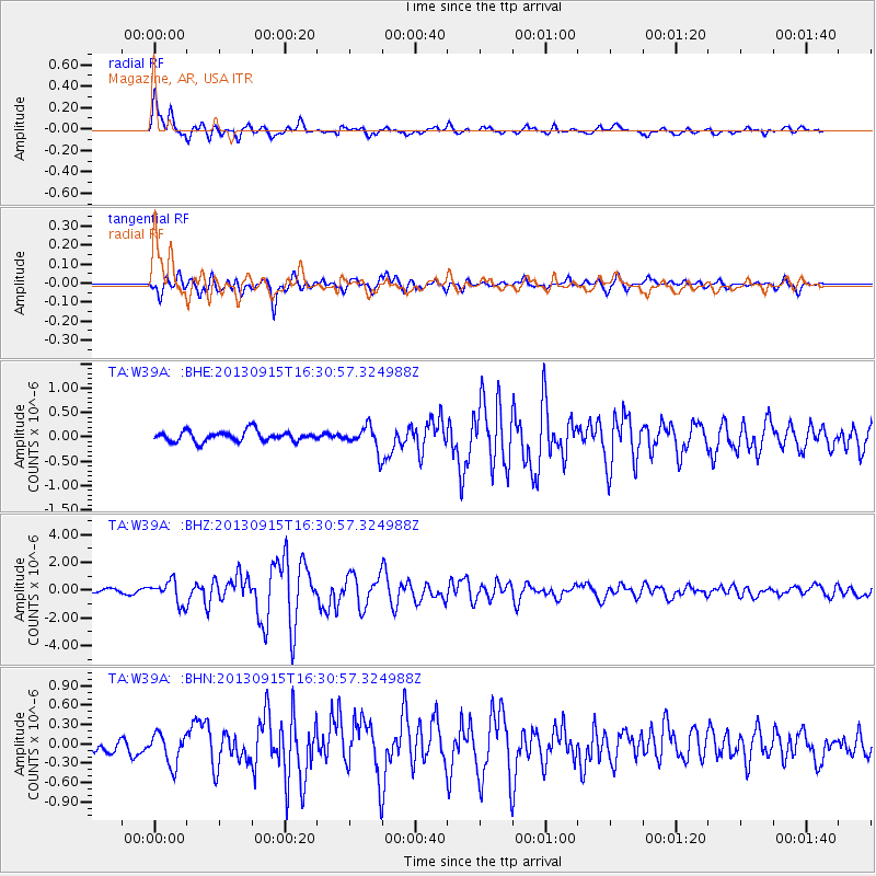
Earthquake location: Andreanof Islands, Aleutian Is.
Earthquake latitude/longitude: 51.6/-174.7
Earthquake time(UTC): 2013/09/15 (258) 16:21:37 GMT
Earthquake Depth: 24 km
Earthquake Magnitude: 6.1 MWW, 5.7 MI, 5.7 ML, 6.0 MWB, 6.1 MWC, 6.1 MWW
Earthquake Catalog/Contributor: NEIC PDE/NEIC COMCAT
Network: TA USArray Transportable Network (new EarthScope stations)
Station: W39A Magazine, AR, USA
Lat/Lon: 35.20 N/93.78 W
Elevation: 162 m
Distance: 58.1 deg
Az: 72.358 deg
Baz: 313.437 deg
Ray Param: 0.06305148
Estimated Moho Depth: 13.5 km
Estimated Crust Vp/Vs: 2.10
Assumed Crust Vp: 6.498 km/s
Estimated Crust Vs: 3.098 km/s
Estimated Crust Poisson's Ratio: 0.35
Radial Match: 88.591545 %
Radial Bump: 400
Transverse Match: 86.985535 %
Transverse Bump: 400
SOD ConfigId: 626651
Insert Time: 2014-04-18 17:36:25.946 +0000
GWidth: 2.5
Max Bumps: 400
Tol: 0.001

Signal To Noise

ChannelStoNSTALTA
TA:W39A: :BHZ:20130915T16:30:57.324988Z3.55586158.109419E-72.2805777E-7
TA:W39A: :BHN:20130915T16:30:57.324988Z2.15600442.411752E-71.1186211E-7
TA:W39A: :BHE:20130915T16:30:57.324988Z2.32678132.4603915E-71.05742274E-7
Arrivals
Ps2.4 SECOND
PpPs6.2 SECOND
PsPs/PpSs8.5 SECOND