W50A Signal Mountain, TN, USA - Earthquake Result Viewer
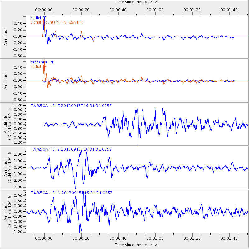
Earthquake location: Andreanof Islands, Aleutian Is.
Earthquake latitude/longitude: 51.6/-174.7
Earthquake time(UTC): 2013/09/15 (258) 16:21:37 GMT
Earthquake Depth: 24 km
Earthquake Magnitude: 6.1 MWW, 5.7 MI, 5.7 ML, 6.0 MWB, 6.1 MWC, 6.1 MWW
Earthquake Catalog/Contributor: NEIC PDE/NEIC COMCAT
Network: TA USArray Transportable Network (new EarthScope stations)
Station: W50A Signal Mountain, TN, USA
Lat/Lon: 35.20 N/85.31 W
Elevation: 587 m
Distance: 63.0 deg
Az: 66.772 deg
Baz: 315.554 deg
Ray Param: 0.05981751
Estimated Moho Depth: 48.0 km
Estimated Crust Vp/Vs: 1.81
Assumed Crust Vp: 6.35 km/s
Estimated Crust Vs: 3.503 km/s
Estimated Crust Poisson's Ratio: 0.28
Radial Match: 93.42409 %
Radial Bump: 400
Transverse Match: 77.670204 %
Transverse Bump: 400
SOD ConfigId: 626651
Insert Time: 2014-04-18 17:36:36.045 +0000
GWidth: 2.5
Max Bumps: 400
Tol: 0.001

Signal To Noise

ChannelStoNSTALTA
TA:W50A: :BHZ:20130915T16:31:31.025Z8.7046939.215153E-71.05864196E-7
TA:W50A: :BHN:20130915T16:31:31.025Z4.8868763.5995228E-77.365692E-8
TA:W50A: :BHE:20130915T16:31:31.025Z3.59705042.9980635E-78.334782E-8
Arrivals
Ps6.4 SECOND
PpPs20 SECOND
PsPs/PpSs27 SECOND