
W53A Cullowhee, NC, USA - Earthquake Result Viewer
| ||||||||||||||||||
| ||||||||||||||||||
| ||||||||||||||||||
|
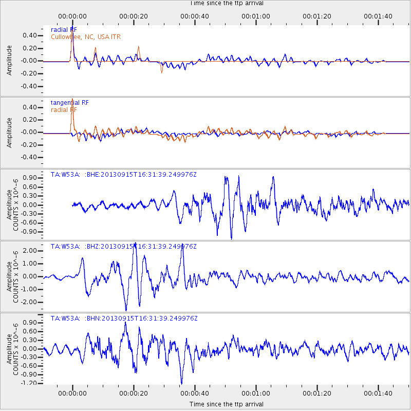
Signal To Noise
| Channel | StoN | STA | LTA |
| TA:W53A: :BHZ:20130915T16:31:39.249976Z | 7.76 | 7.0256965E-7 | 9.053733E-8 |
| TA:W53A: :BHN:20130915T16:31:39.249976Z | 2.0318837 | 2.2198826E-7 | 1.0925244E-7 |
| TA:W53A: :BHE:20130915T16:31:39.249976Z | 3.4467795 | 2.5185685E-7 | 7.307019E-8 |
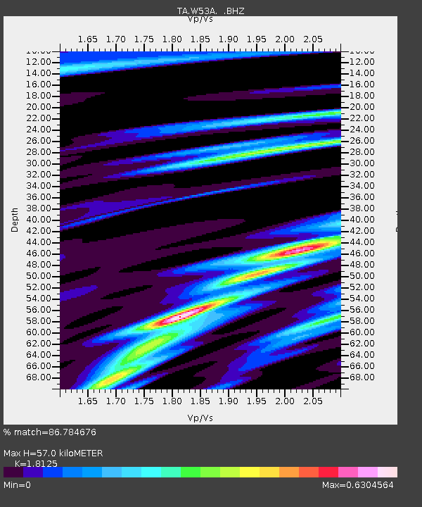
| Arrivals | |
| Ps | 7.6 SECOND |
| PpPs | 24 SECOND |
| PsPs/PpSs | 32 SECOND |

