W52A Murphy, NC, USA - Earthquake Result Viewer
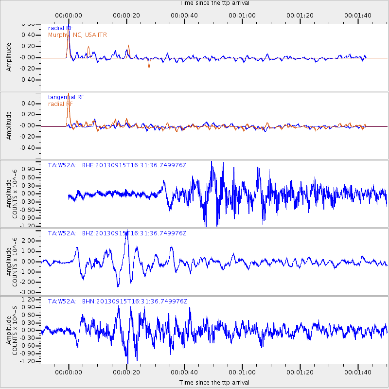
Earthquake location: Andreanof Islands, Aleutian Is.
Earthquake latitude/longitude: 51.6/-174.7
Earthquake time(UTC): 2013/09/15 (258) 16:21:37 GMT
Earthquake Depth: 24 km
Earthquake Magnitude: 6.1 MWW, 5.7 MI, 5.7 ML, 6.0 MWB, 6.1 MWC, 6.1 MWW
Earthquake Catalog/Contributor: NEIC PDE/NEIC COMCAT
Network: TA USArray Transportable Network (new EarthScope stations)
Station: W52A Murphy, NC, USA
Lat/Lon: 35.09 N/83.93 W
Elevation: 519 m
Distance: 63.9 deg
Az: 65.947 deg
Baz: 315.978 deg
Ray Param: 0.059252337
Estimated Moho Depth: 19.0 km
Estimated Crust Vp/Vs: 1.97
Assumed Crust Vp: 6.35 km/s
Estimated Crust Vs: 3.223 km/s
Estimated Crust Poisson's Ratio: 0.33
Radial Match: 93.79436 %
Radial Bump: 400
Transverse Match: 73.345795 %
Transverse Bump: 400
SOD ConfigId: 626651
Insert Time: 2014-04-18 17:36:45.199 +0000
GWidth: 2.5
Max Bumps: 400
Tol: 0.001

Signal To Noise

ChannelStoNSTALTA
TA:W52A: :BHZ:20130915T16:31:36.749976Z6.57366047.6838484E-71.1688842E-7
TA:W52A: :BHN:20130915T16:31:36.749976Z2.28507112.6416913E-71.15606525E-7
TA:W52A: :BHE:20130915T16:31:36.749976Z3.0390632.3657039E-77.7843204E-8
Arrivals
Ps3.0 SECOND
PpPs8.6 SECOND
PsPs/PpSs12 SECOND