
W54A Cherokee Point, Campobello, SC, USA - Earthquake Result Viewer
| ||||||||||||||||||
| ||||||||||||||||||
| ||||||||||||||||||
|
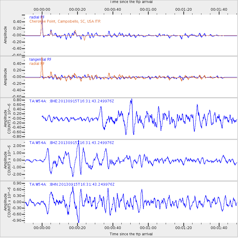
Signal To Noise
| Channel | StoN | STA | LTA |
| TA:W54A: :BHZ:20130915T16:31:43.249976Z | 6.935877 | 8.4519104E-7 | 1.2185785E-7 |
| TA:W54A: :BHN:20130915T16:31:43.249976Z | 2.9842155 | 2.761165E-7 | 9.252565E-8 |
| TA:W54A: :BHE:20130915T16:31:43.249976Z | 3.8683903 | 2.3441541E-7 | 6.0597664E-8 |
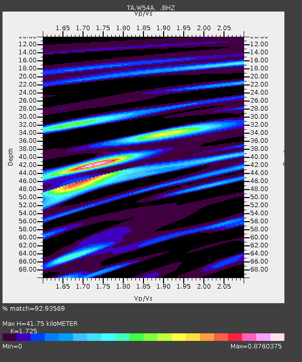
| Arrivals | |
| Ps | 5.0 SECOND |
| PpPs | 17 SECOND |
| PsPs/PpSs | 22 SECOND |

